
The TOUR DE CAPO DI MORU stands between the GOLFE D’AJACCIO and GOLFE DE VALINCO. From here, you pass a typical farmhouse, with bread oven before travelling further onto the headland and dropping down to the coast and a chaos of rocks. Here you find the atmospheric CHAPELLE A MADONUCCIA, and an ideal picnic spot under the tamarisk trees. The route then takes you around the headland, discovering the small lighthouse and this untouched coast before climbing again to a large track that takes you back to the start of your walk. If time at the end of the walk, you could drop down to the beach at CALA D’ORZU and paillote Chez Francis.
“A tower, a lighthouse, a chapel, a farmstead, a maquis covered, windswept headland, a superb picnic spot, just a short drive from Ajaccio.
A bit of scrambling over rocks and the sound of the crashing of the waves on the headland make this walk “wild and free” walking at its best.”
10km, 3h30, +/- 250m, Some conservatoire signs indicating the main directions and cairns but not well marked.
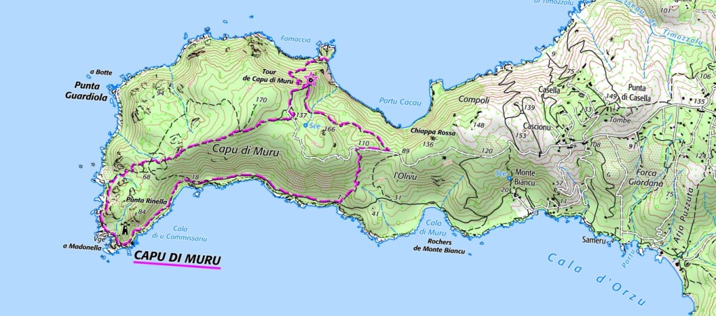
- Parking area (to Capu di Muro Tower) 0h45 / 2km
Your walk starts climbing along the track from the parking area, ignoring a broken tarmac road to the right and passing a first broken barrier. The track climbs and leaves the main track as it bears left and falls gently, leading out onto the headland. The path is occasionally marked with green painted arrows, is at times quite rutted and eroded and others gentle underfoot, after about 0h15 you arrive at a pass with a tree and a sign for the CONSERVATOIRE DU LITTORAL, a narrower path leads off under the trees to the right to Capu di Muru Tower which is in your sights. The path passes through woodland until the tower. Climb this to have splendid views out over the golfe d’Ajaccio.
- Tower (to the house) 0h10 / 0,5km
From the tower steps, the path crosses the rocks and you take a climbing path up to the ridge, ignoring a right turn after 15m that drops down to the coast below. Continue uphill on the well defined path, after another 0h05 or so you reach the house at Capu di Muro.
- The house (to the A Madonella chapel) 1h15 / 3km
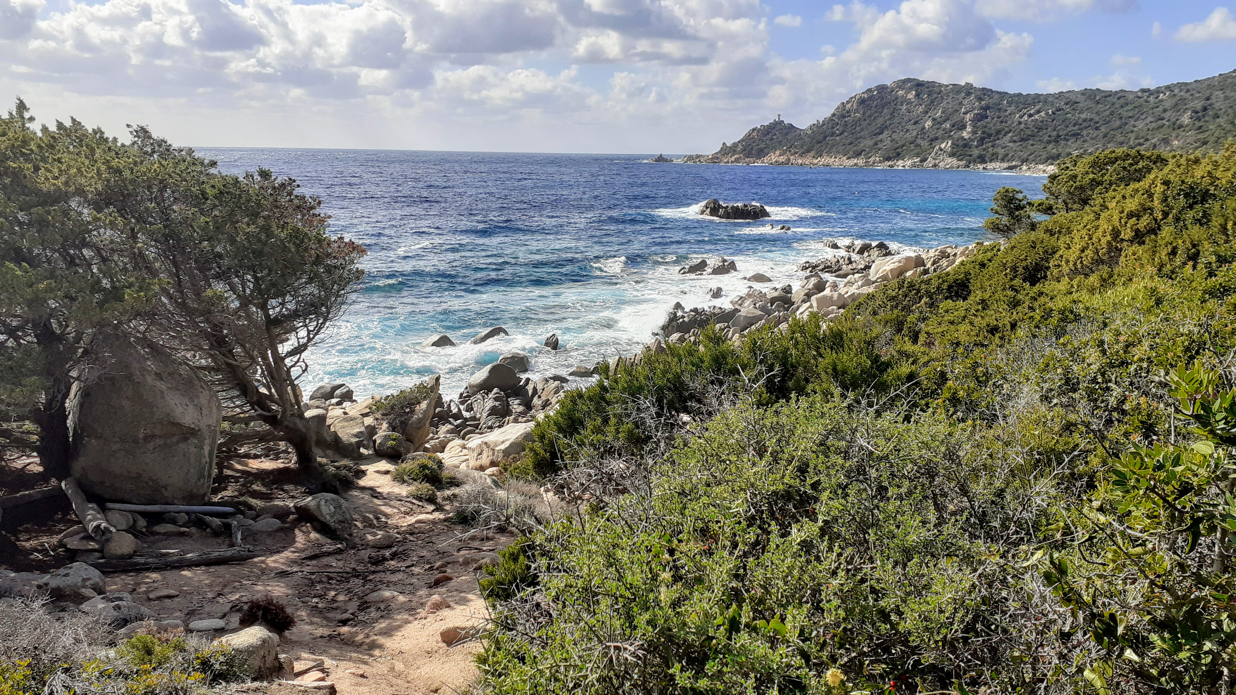
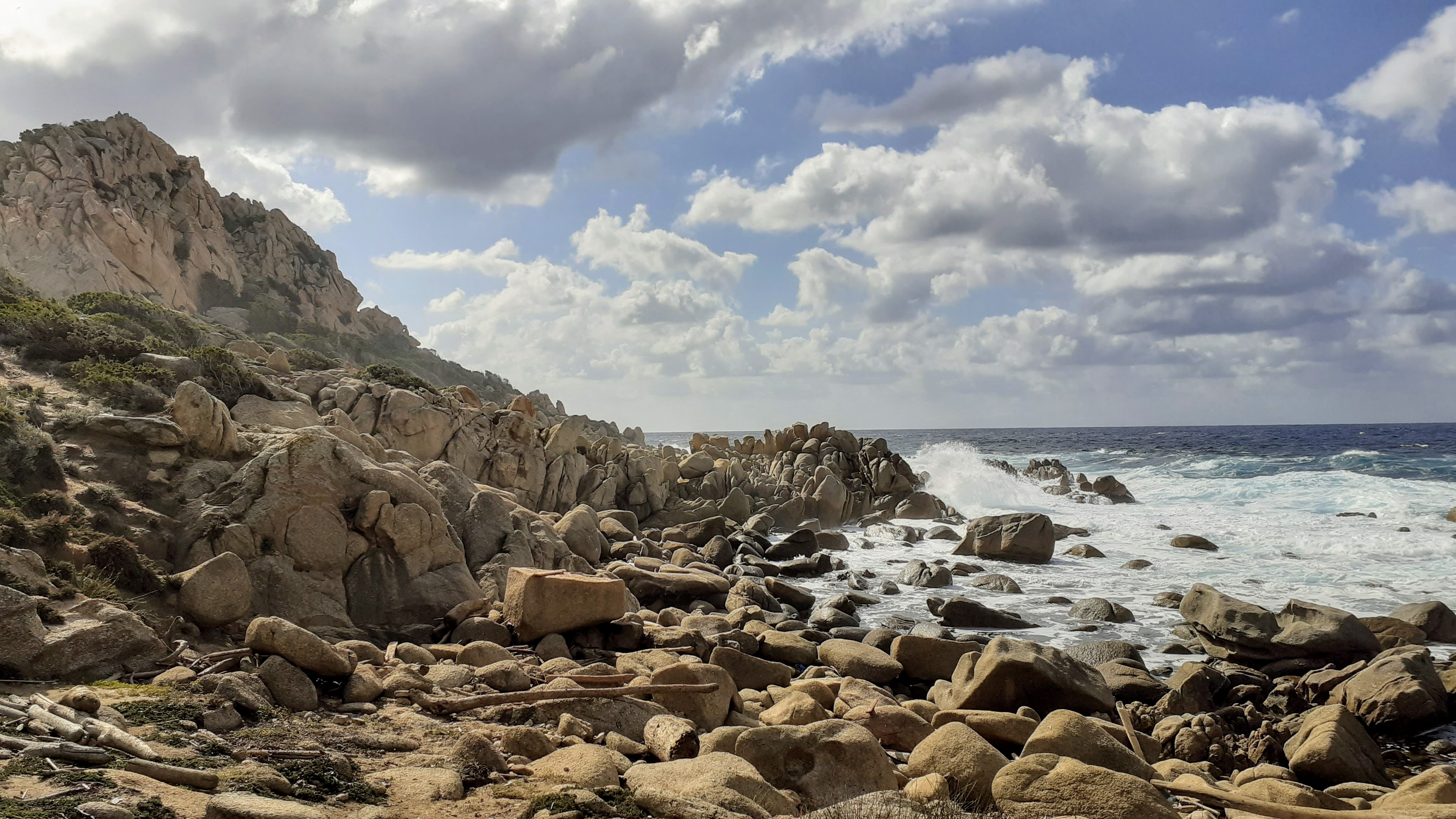
From the house, cross the open area and take the path to the right passing a bread oven after 25m. The path leads out initially across an open area before entering light woodland, opening out again onto lower maquis before the long and sometimes eroded descent to the sea. You are soon see the waves below, dropping down now steeply towards the coast and a grassy area behind the sea. Facing the sea, turn left before the big rock to follow the path above the sea, way-marked with cairns. The landscape soon changes. The footpath scrambles around the headland, up and over a low ridge of jumbled boulders before dropping into a sandy cove, backed by a field of Immortelle below the lighthouse at Capu di Muru. You will find here the Madonnella chapel, and just behind it under the trees next to the Imortelle field, a great place for a picnic.


- A Madonella (to start of walk) 1h20 / 4.5km
From the front of the chapel, find the CONSERVATOIRE DU LITTORAL sign and keep low to the right of it, continue around the coast following the cairns, you will soon see the ruined boathouse below the path, then a narrow path on the left that climbs steeply zig-zagging up to the lighthouse (a quick there and back for a good view). The path then follows the coast until it veers steeply up to the left before reaching a wall, from where it climbs to meet the track you were on earlier. Turn right, after a short walk along this falling track, you will see again the CONSERVATOIRE DU LITTORAL sign, head straight on to get back to the car parking area. At the end of the walk, the beach at CALA D’ORZU and the famous “paillote” CHEZ FRANCIS are a short walk downhill (approx 1.5km each way from the parking area). Continue walking and follow the signs down a dirt track to the right for CHEZ FRANCIS.
- Parking area


