Easy cliff walk towards the lighthouse at PERTUSATO with magnificent views of BONIFACIO. This walk can be adapted from an easy stroll to a more challenging hike. Great at any time of year.

10km return / 1h40 to 4h00 depending on how far you go /+/- 100m
DUE CARE SHOULD BE TAKEN ON THE CLIFFS ! DO NOT GO OFF TRAIL & STAY AWAY FROM ANY UNGUARDED EDGES
- Col St Roch (to Road) 0h45 / 1.5km
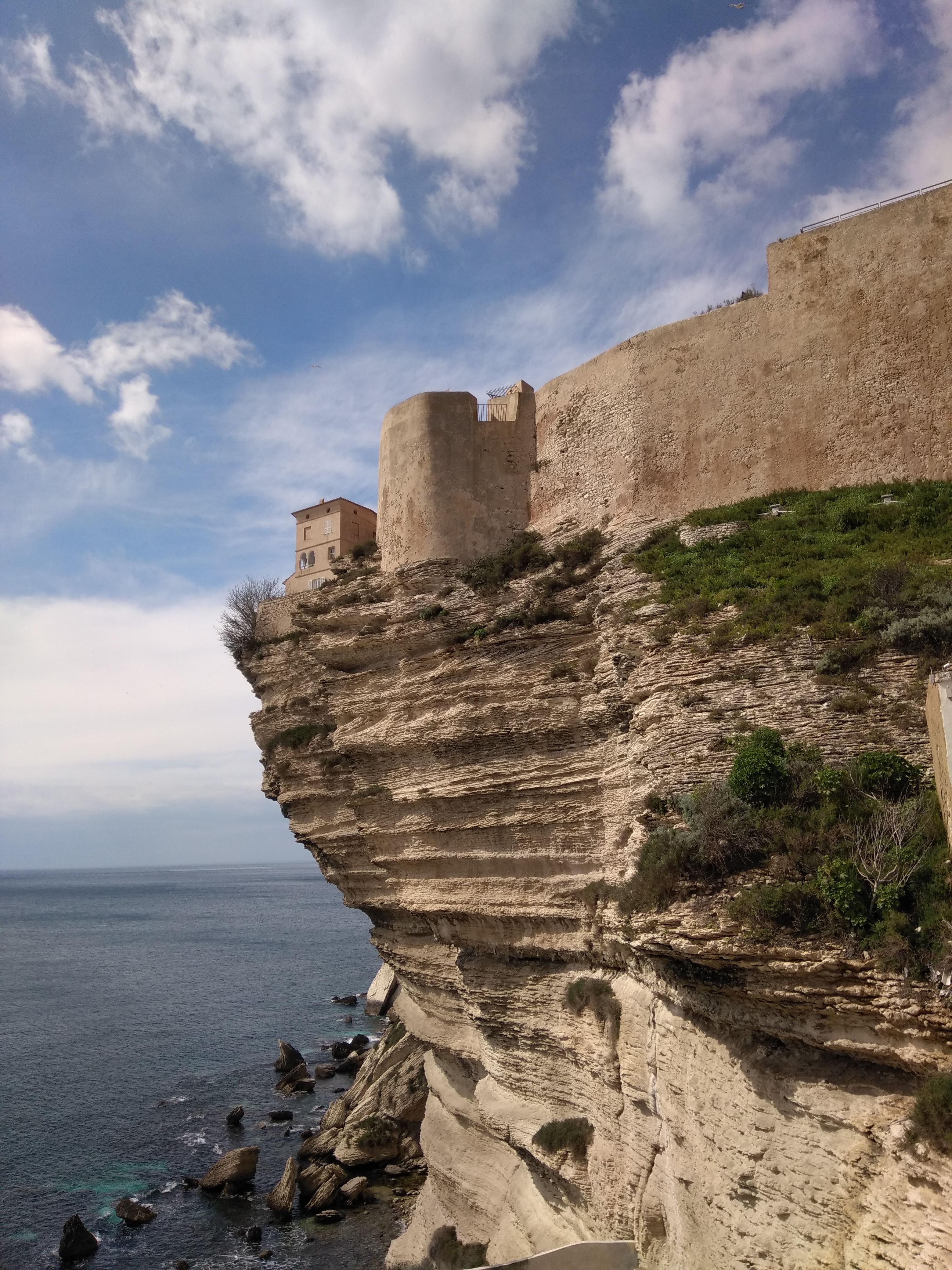
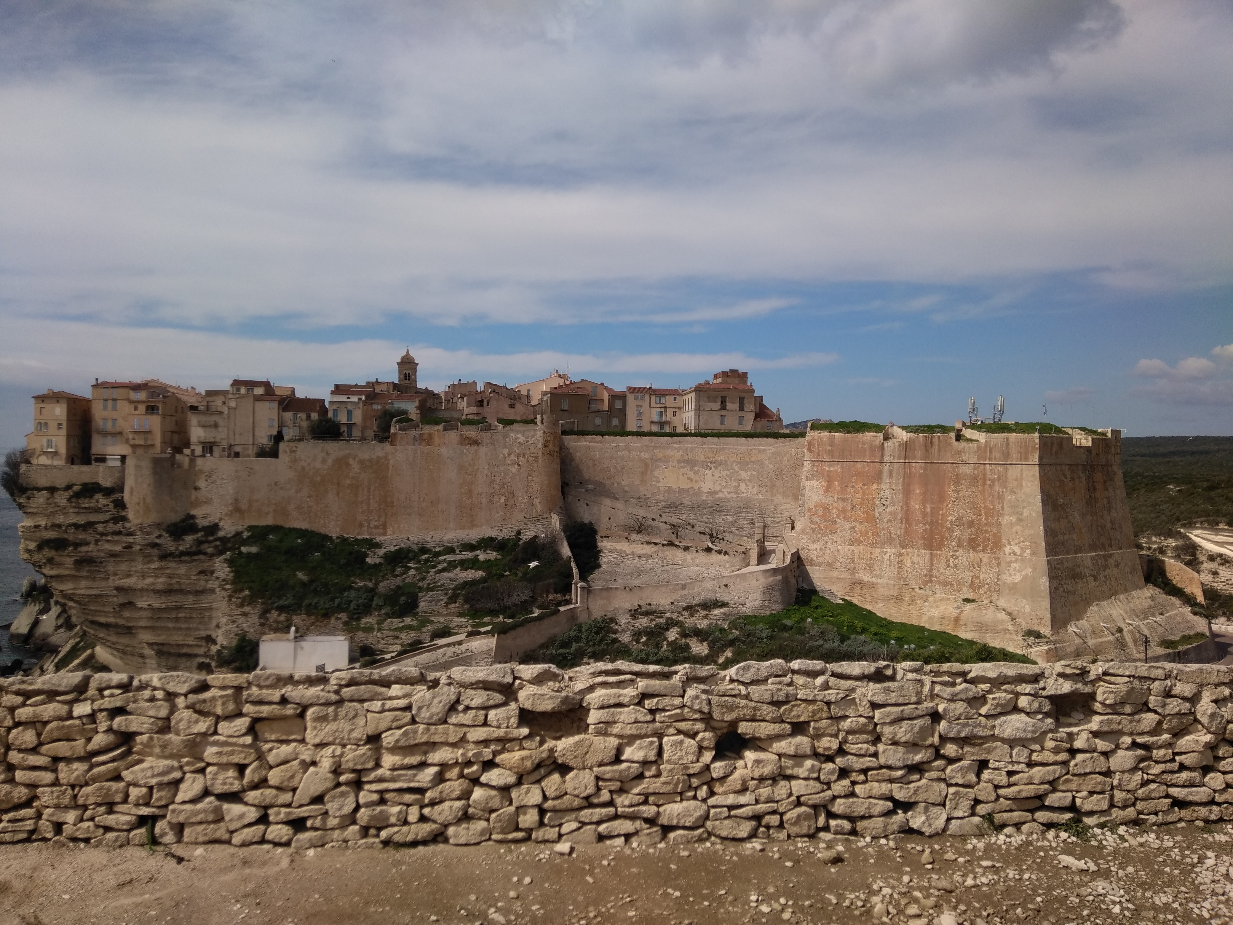
From the HAUTE VILLE and the BASTION DE L’ETENDARD, drop down via the PORT DE GÊNES gateway to the east of the town to the white CHAPEL ST ROCH. With your back to the white chapel and Haute ville climb ahead, along the stone laid ramp that leads towards the cliff top paths made by the Conservatoire du Littoral.
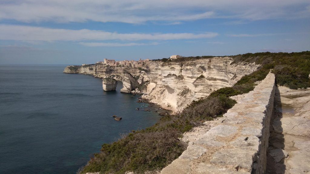
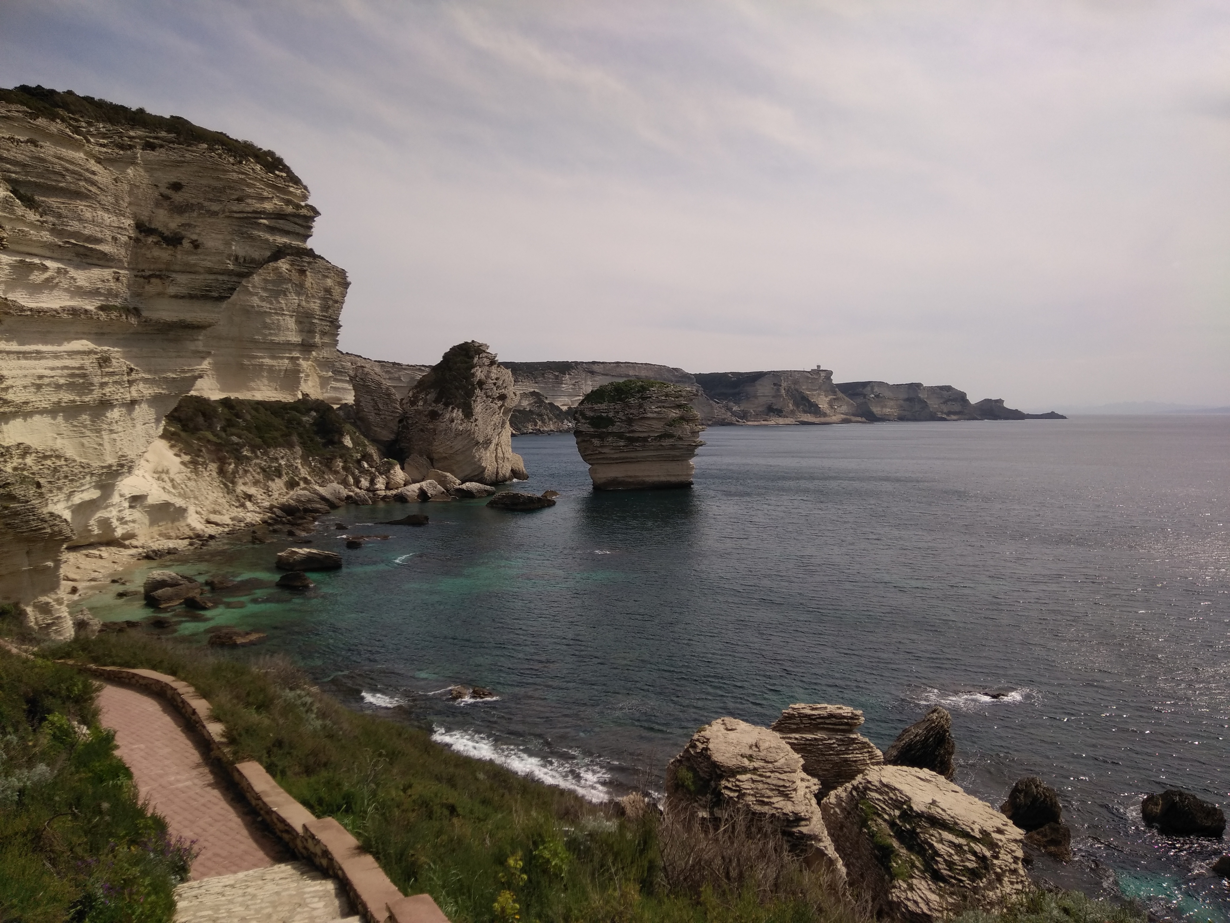
Take the CAMPU RUMANILU path, turn your head for spectacular views back towards the medieval Citadel with its houses perched vertiginously over the cliffs. For the most views, after a short climb (3 mins) you see a ruined building ahead. To your right switching back, there are stone steps that climb into the maquis, heading towards the coast. Climb here, and you will find a succession of viewing platforms across this natural area, the CAMPU RUMANILU. The trail follows the clifftops with superb views to the right – the turquoise waters and SARDINIA, ahead the lighthouse and to the left the fragrant clifftop maquis, and looking back sublime views of the Citadelle of BONIFACIO. There are a number of paths that follow near to or further from the edge.
NB. For a shorter walk (1h00), you will soon arrive at a small building overlooking the cliffs, this was the abattoir for the town. Facing away from the town, you can loop back towards the port from the ruins of the Abattoir on a path at right angles to the cliff (ie to your left). Or return on the path you came on.
If continuing straight ahead for the longer walk. Take the path along parallel to the road and cliffs after a further 10 minutes you leave the tidy paths of the CAMPU RUMANILU sign. The cliffs from here are unguarded. TAKE CARE & STAY AWAY FROM THE CLIFF EDGE. Climbing, you will soon be on a path parallel and close to a tarmac road. Follow parallel to this until you reach after a further 20 mins the road junction for PERTUSATO.
- Road (to Pertusato Old Lighthouse) 1h10 /2.5km
Follow the road (to the right), which soon becomes narrow towards the large white military semaphore PERTUSATO and the old lighthouse, passing a building you soon see the ruins of old military batteries. This is an interesting “ghost village”, but care should be taken as the drops are unguarded.
After a further 400m on the road, you arrive at the new semaphore. From here the road is not practicable by car, there is a variation to this walk from the SEMAPHORE find the extension around the CAPU PERSATO on another blog post.
Continue down the road into the gulley – from here you can either continue on the road or you can take a shortcut to the lighthouse that climbs straight ahead, the path leads up into the maquis just before the road switches back to the right back to the coast. You can see on the map the shortcut.


For the shortcut. On reaching the road again, note opposite the sign to visit the sandy bay at SAINT ANTOINE below the old lighthouse (walk along the road first to see the lighthouse). Someone has helpfully written PLAGE in green paint on the road, with an arrow to your right from this direction.
For the beach, turn off the road towards the sea, and then you see the start of the path. The path is limestone strata, care should be taken, especially in the first 50m or so of the descent. The path then becomes gentler, dropping down to the beach at SAINT ANTOINE, A tip, before reaching the beach, a path crosses to your right, so that you can see the GROTTE DE L’ORCA, a collapsed seacave. The beach is a great spot for a picnic.


