
A mini-walk from my doorstep, not on the IGN maps, it was our COVID 1km lockdown walk and allows you to explore the maquis covered hillside with views over the Ajaccio golf “off the beaten track”.
“This was s favourite walk for us as it is on our doorstep. Not well waymarked and with some scrambles, but a fine rock arch and a medieval fortress hilltop with great panoramic views over the Prunelli valley and the mountains behind. PLEASE NOTE – Since writing this up we have been advised the path crosses private land and should not be used as too many people are using it…”
3km, 2h00, +/-160m, some YELLOW, some mauve

This walk starts at the village of CAURO, our home for nearly 4 years. The best place to park in the village is the small parking area by the church. You can do a second “summit” from the church, described at the end. A lot of descriptions locally describe this as an easy walk. I’d suggest it is short, but there are a few more technical sections and “drops” that are not, in my opinion, suitable for younger members of the family or those with vertigo.
- CAURO CHURCH (to La Rocca) 0h40 / 2km
From the parking area at the church, facing towards the bell tower, take the road that passes the church, then the flat track that continues straight ahead as the concrete road climbs to the left. Continue along the grassy track passing below woodland, you pass graves, then a tomb chapel, then reach a junction with a private lane just above the main T40 road.
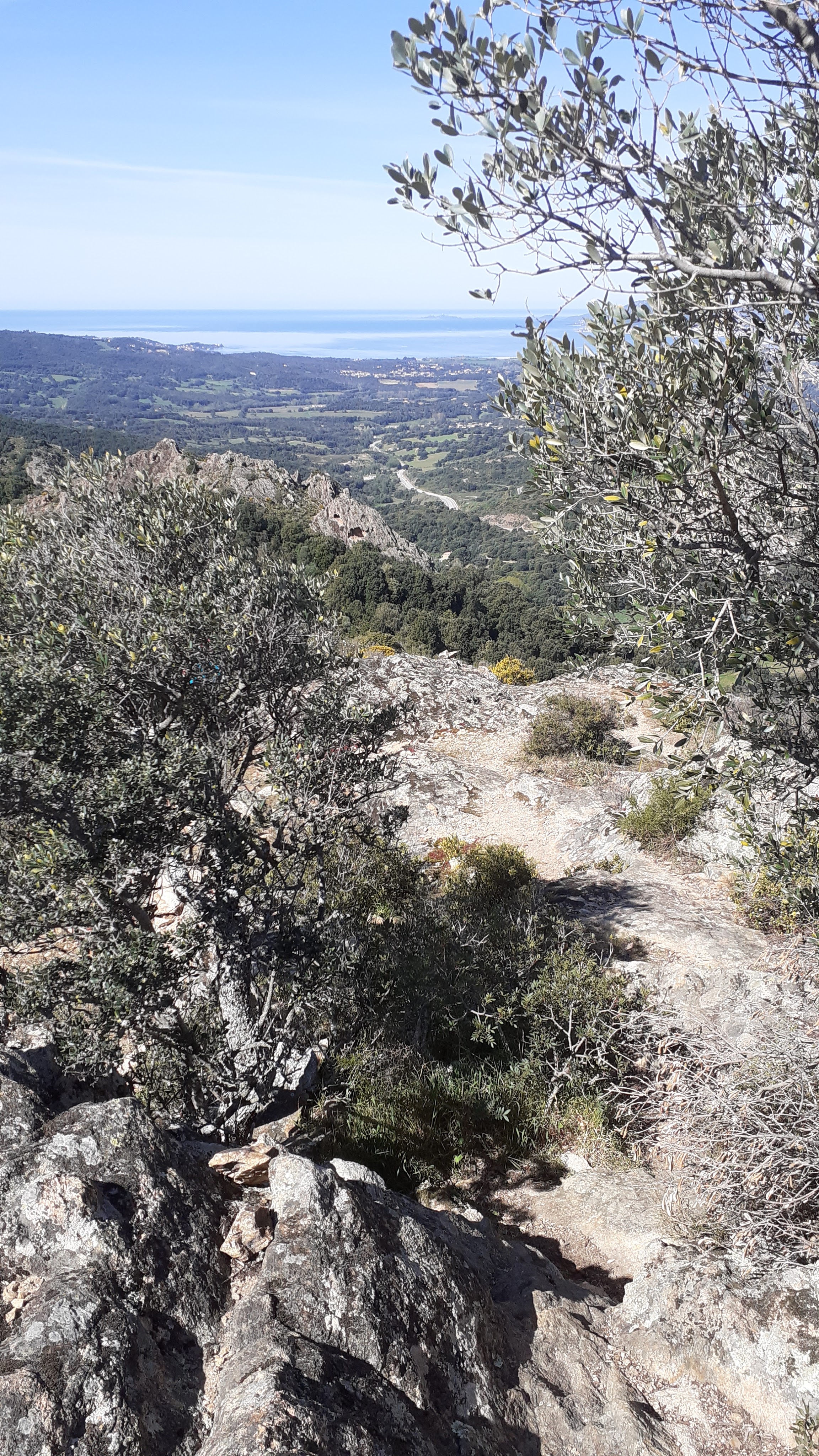
At this junction, turn left soon passing a residence ‘Aja di Muro‘. Continue along the lane until you arrive at a metal gate to a private villa. Turn right at this gate walking alongside the fence of the property, through the undergrowth, and you soon reach an open field. Cross the field and climb steeply into the woodland opposite, and at the top of the climb, turn left onto more open, maquis covered, rocky land. Cross this hillside, after about 200m the path again enters woodland. The path starts off flat but climbs steeply to exit the wood. Opening out again, the path is easy to follow, on a relatively easy “stroll” with some rock slabs to climb up from time to time, all the way until the view of the summit opens up at the foot of LA ROCCA.
From here, the summit is ahead of you, there are huge rocky slabs with little vegetation apart from lichen and moss, and the odd lone tree. You should see a Corsica symbol on a rockface to the left of the hill – you are heading for this.
You start the climb up over the rocky slabs, the path then crosses, away from the CAURO valley, and leaves a small grassy area, zig-zaging up under a lone olive tree with the odd waymark – NB you can come back to this point later on the way down.
The path leaves this small patch of vegetation, heading back towards the valley along a rocky ledge past the metal Corsica symbol that has been added to a rock face. After this passage the path passes between rocks, and splits at a junction.
- LA ROCCA (to Arche de Cauro) 0h20/ 0.5km
At this junction, below you, you can just make out a yellow faded waymark indicating the path to L’ARCHE. (NB For a shorter summit walk, turn uphill from here to LA ROCCA above you – see description below*).
If continuing to the ARCHE DE CAURO, from this junction, just after the metal Corsica symbol, there is a steep downhill rocky section that requires care. You are heading across the slope downhill, in a rough zig-zag – any which way you can to be honest – to reach the olive trees below. The path after the trees cannot be seen from above, but it flattens under the trees to more of a balcony path that skirts around the foot of LA ROCCA, crossing some more rocky sections.
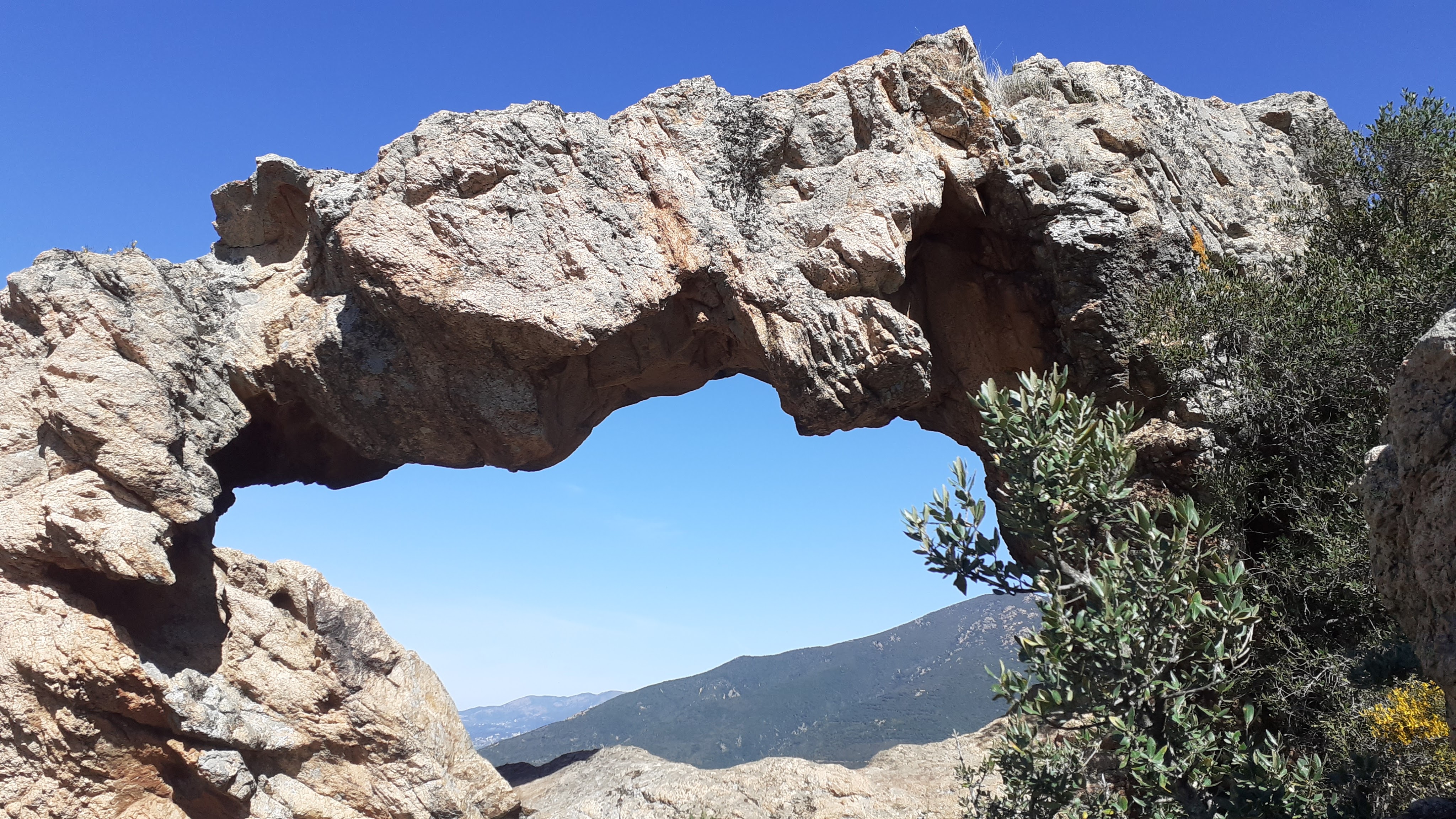
Once past the rocky summit of LA ROCCA, the path opens up to maquis and you see a few cairns and a dry stone wall on the ridge line in front of you. Turn left at the wall, following the wall as the view opens up to the GOLFE D’AJACCIO. You follow the wall, more or less, all the way to the ARCHE DE CAURO. As the path moves around on the CAURO valley side of the ridge on a rocky balcony path, the ARCHE DE CAURO suddenly comes into view. The ARCHE DE CAURO is a natural and pretty solid rock formation that can be seen from both sides. Pause for a while to take in the view of MONT ARAGNASCU and AJACCIO, before continuing a further 100m where the path abruptly ends at the point SALIVI above the gorge.


- L’ARCHE DE CAURO (to La Rocca) 0h20 /0.5km
From here retrace your steps to the foot of LA ROCCA. Here there is a scramble to the summit on the left hand (PRUNELLI valley) side of the summit. The route is traced by cairns but it is a real scramble and not for the feint hearted so if this isn’t for you, retrace your steps to the right (CAURO village) side of the summit, along the path you followed earlier to get here, climbing steeply up the rocks from the olive trees at the base of LA ROCCA to the junction you were at earlier.

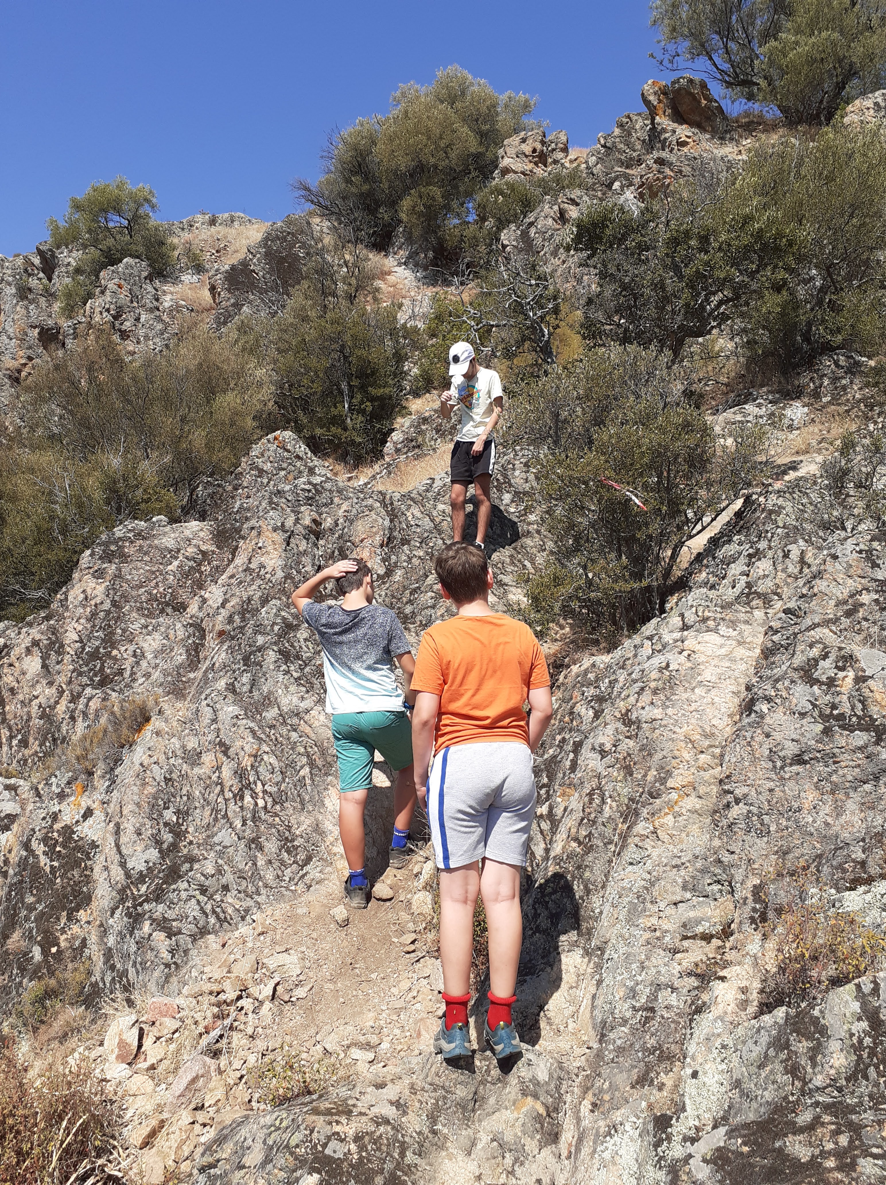
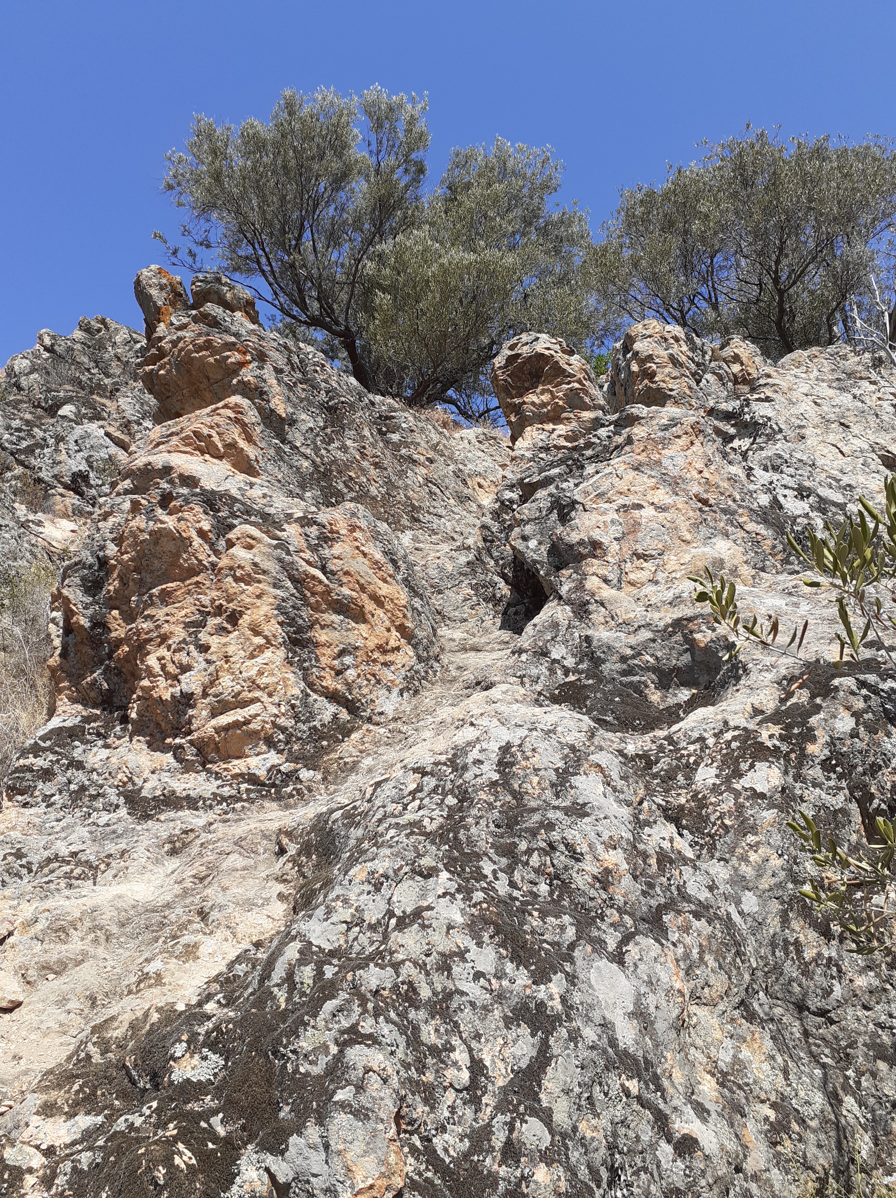
From here, for the summit of LA ROCCA*, continue straight on uphill, up the “V” shaped gully ahead, past a small bush, then up left, then right on a zig-zag path, which ends in a steep rocky gully little more than a few metres long. You will need your hands and you need to be nimble as it is pretty vertical but the rocky gully soon comes out below the summit at olive trees. From here the easiest route after this scramble is to skirt around the right hand side of the plateau, before climbing to your left to discover the flag and the view.
Historically there was a fortification on this site, from the 13th to the 15th century, controlled by the Lords of Ornano. The fort controlled access to the Prunelli valley and was part of a strong local defensive network. After the Lords of Ornano revolted against the governers of Genoa, the castle was taken in a fierce battle, and demolished stone by stone by the troops of the Genoese commissioner Battista Doria in 1454. The fort has left little trace apart from a stone water tank carved into the rock.
- LA ROCCA (to Cauro) 0h40 / 2km
You can either retrace your steps down the gully you have just climbed and continuing past the Corsica symbol in the rock, or, heading back to the olive trees, you will see someone has put some red and white tape in one of the trees indicating an alternative route down. Head to the left of this tree, crossing the slope towards the rocks, then switch back, left following paralel to the rocks. At a grassy area, switch back right again, and switch left and right again to reach a flatter ledge path that leads to the path you came in on earlier, near the olive tree.
Continue on down the rocky slabs and rejoin the path that drops downhill, through the maquis and into woodland and then across the rocky maquis covered slope from where you can see the cross on a neighbouring hill. Go downhill through the wood at the end and into the field. Pass the villa, and turn left onto the track you came in on earlier retracing your steps for the church.

For an extension walk from Cauro, on arriving at the church, take the climbing concrete track that switches back uphill towards houses. Continue straight ahead past the last house, keep towards the boundary fence and head to the right, past the tomb. You find yourself on a steady climbing path that reaches the cross and a stunning view, just 250m from the Church.


