“A favourite Corte walk, for locals and tourists alike, easily accesible from town.”
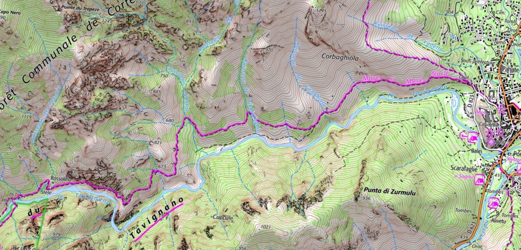
The TAVIGNANU gorge is one of Corsica’s most beautiful spots and a firm favouite with locals and tourists alike. Unlike the open pine escarpments of the nearby RESTONICA valley, the TAVIGNANO is deep, enclosed and offers glimpses of large rock pools below. This age old mule track once provided the way into the neighbouring NIOLU valley and now forms part of the MARE A MARE NORD. The path up through the TAVIGNANO is very Mediterranean, blue-black lavender, curry plant and other wild herbs. Swim spots in the river.
12.5km / 5h00 / +/ -310m / ORANGE
Two springs but take plenty of water (2 litres minimum)
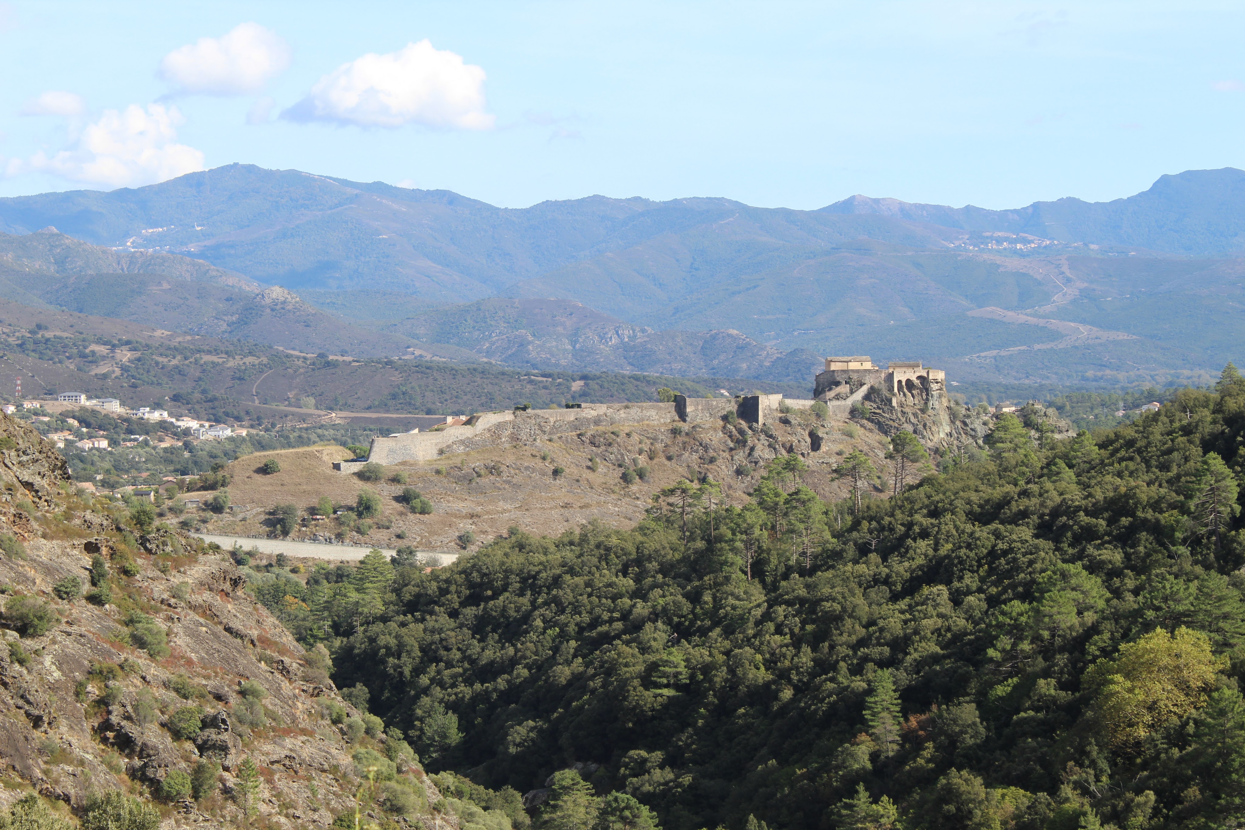
Make your way to the start of walk – at the top of the town behind the citadelle. There is a parking area nearby (payable). The gorge entrance is marked by a cross and ORATOIRES on map. Signposted MARE A MARE NORD REFUGE DE LA SEGA.
- Oratoires (to Ravine d’Anita) 1h30 / 3.5km
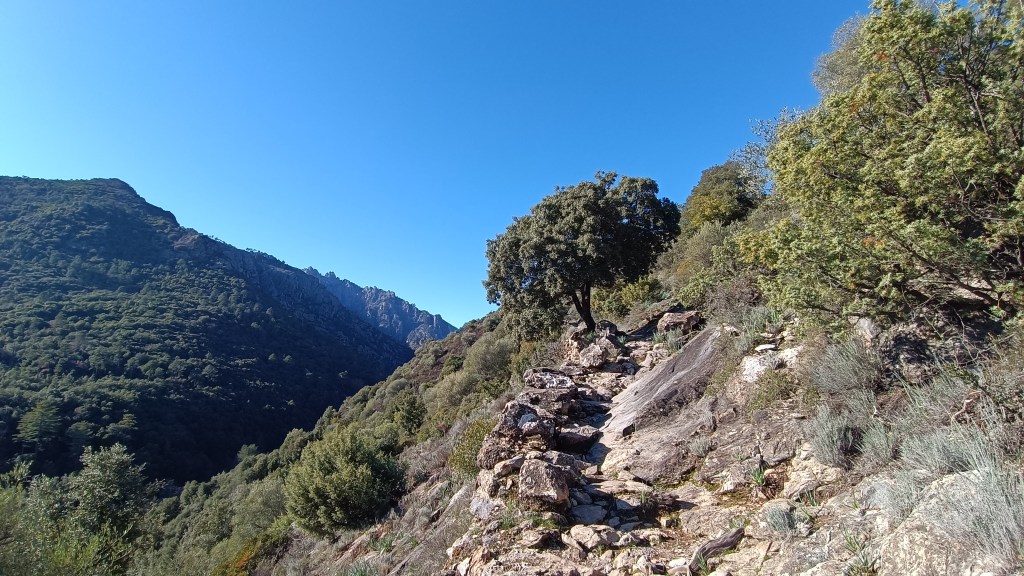
A wooden sign indicates the entrance of the TAVIGNANO GORGE. BEWARE at the start not to take a track that heads straight down to the river, or the track higher up the road that leads steeply up the open hillside above the town. Take the paved mule track, the MARE À MARE NORD way marked ORANGE into the gorge. Your trail will undulate, but stays, more or less, on the level. Rock rose and lavender line the path. After about 1.5 kms into the gorge, there is a gate and a small garden with a picnic table and a chapelle on the right above the path. You can find a spring here where you can top up your water.
Further on, at 2km you come to an intersection of 3 paths. The middle one is the main path, continuing straight on into the gorge, the path on the left drops down to the river. NB If you drop down to the river, you will come across some large rock pools. You can retrace your steps back to this intersection, or continue on a lower scramble that runs parallel to the river. It links back up to the main track by a very steep, eroded, dusty climb, emerging at the rocky plateau view point app 1km before the suspension footbridge. If you continue straight ahead on main path, you will come to a stream marked ANTIA on your maps. There is a stone bergerie in the woods and a good place to have a rest stop with pool and shade.


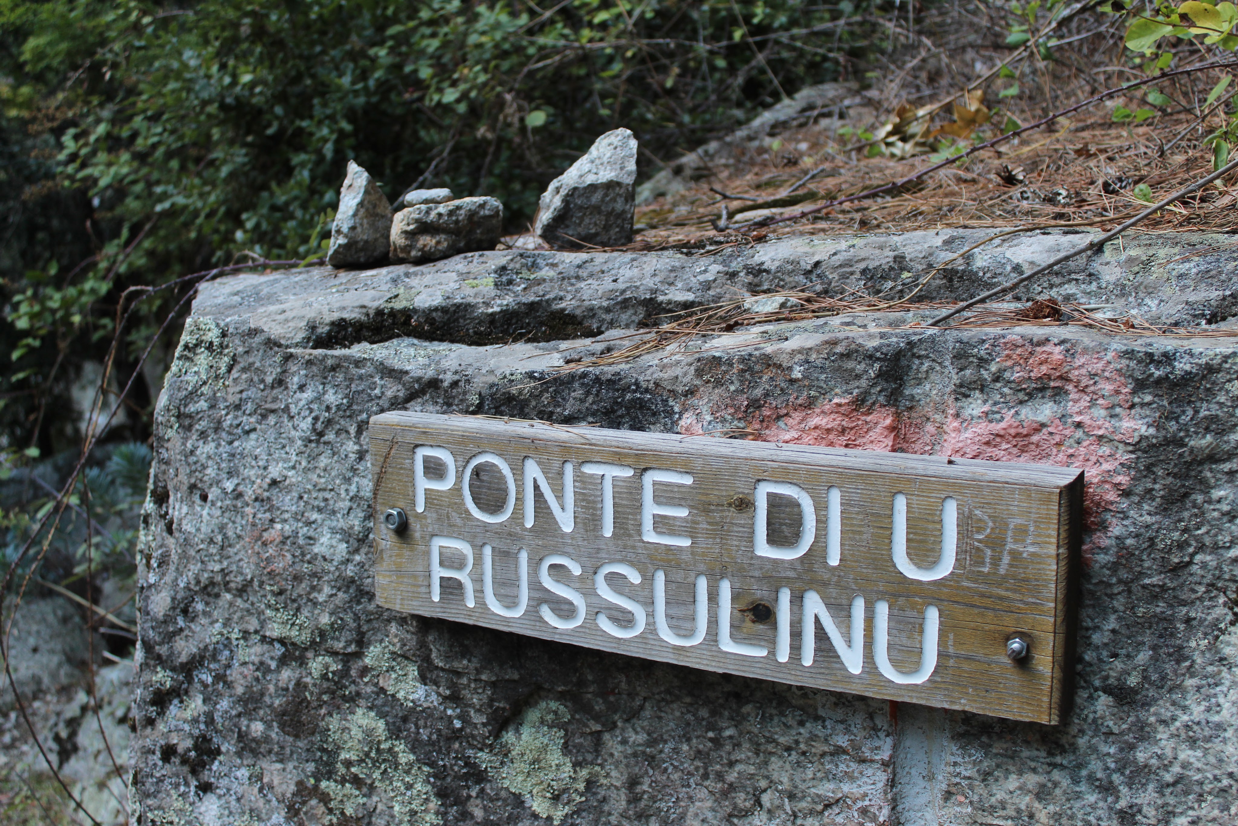

- Rav d’Antia (to Pasarelle Russulinu) 1h00 / 2.75km
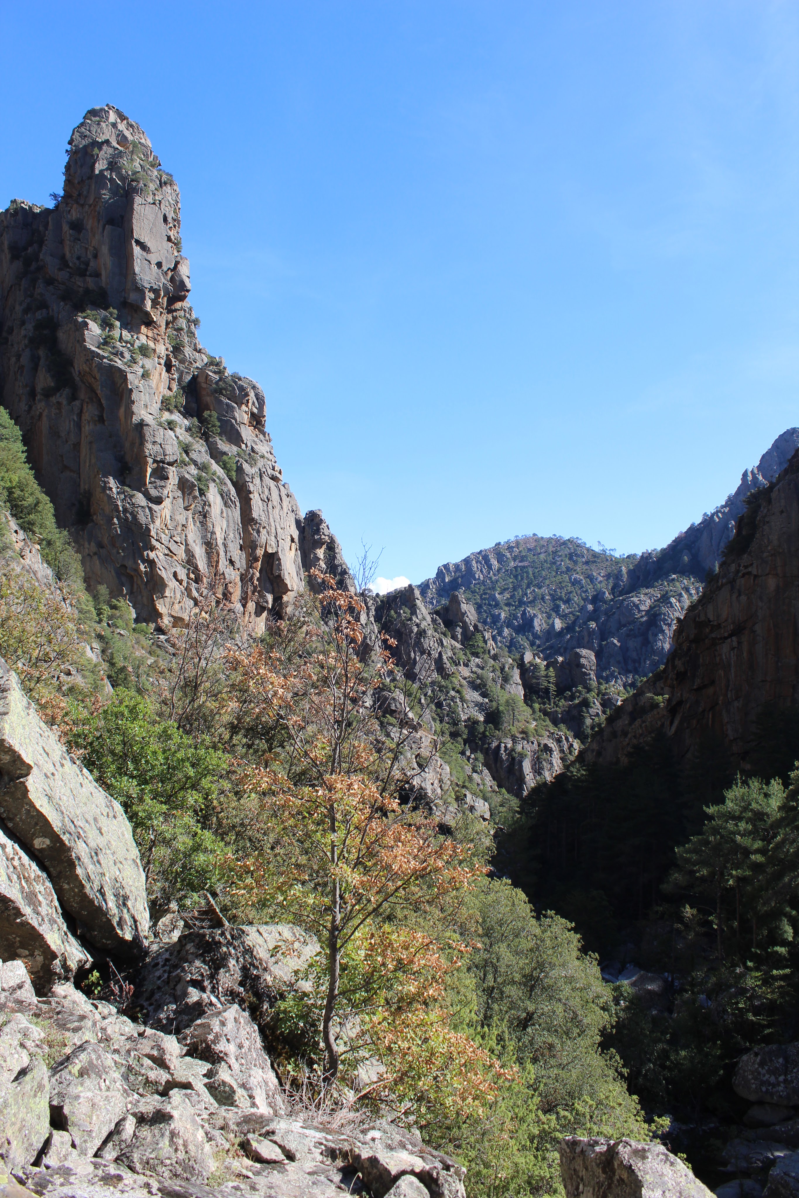
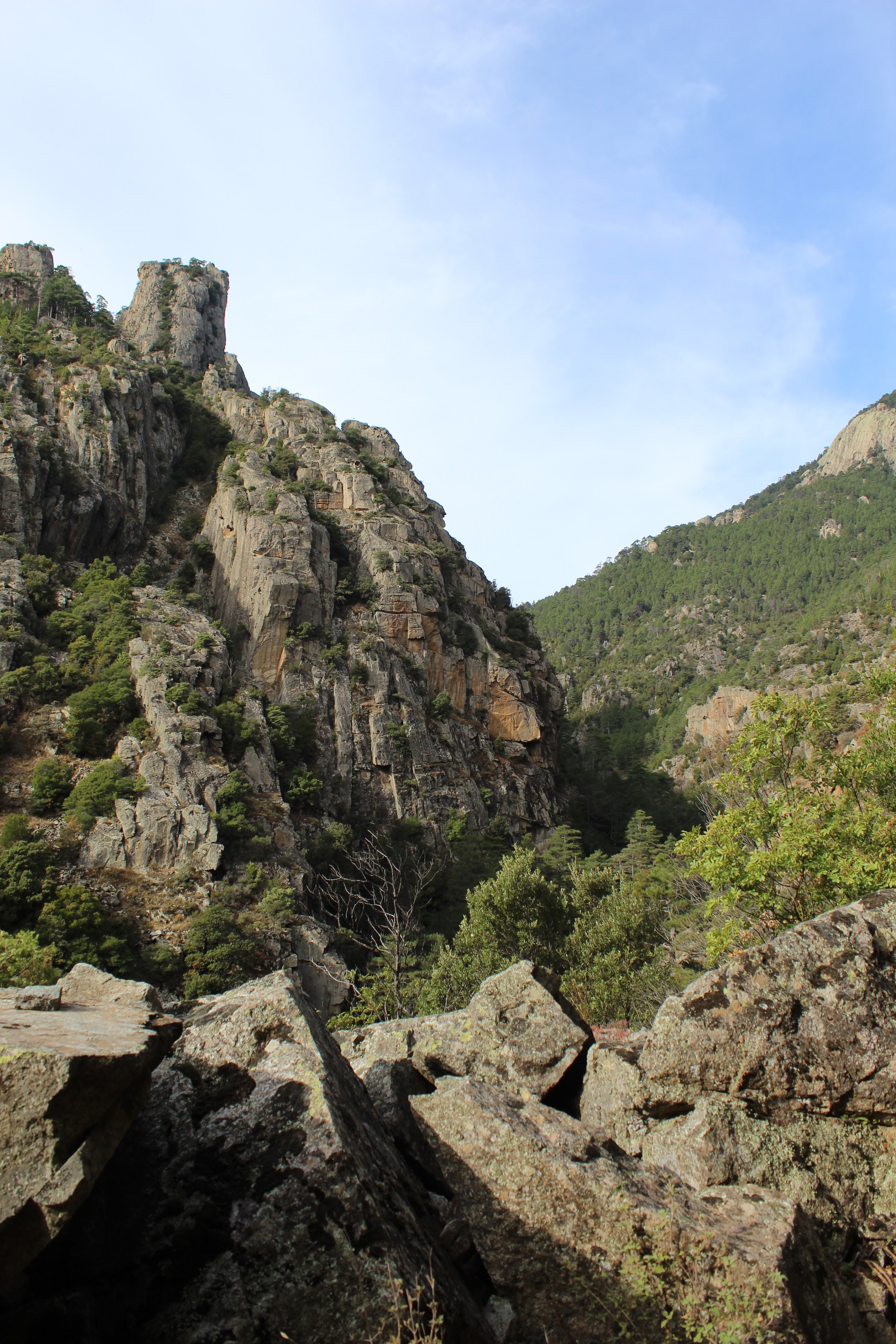
You continue to climb as you walk further into the gorge, after 1km you will come to a sharp bend in the trail and on the left, there is a distinctive rocky plateau on the very edge of the trail, here there are great views of the river below.
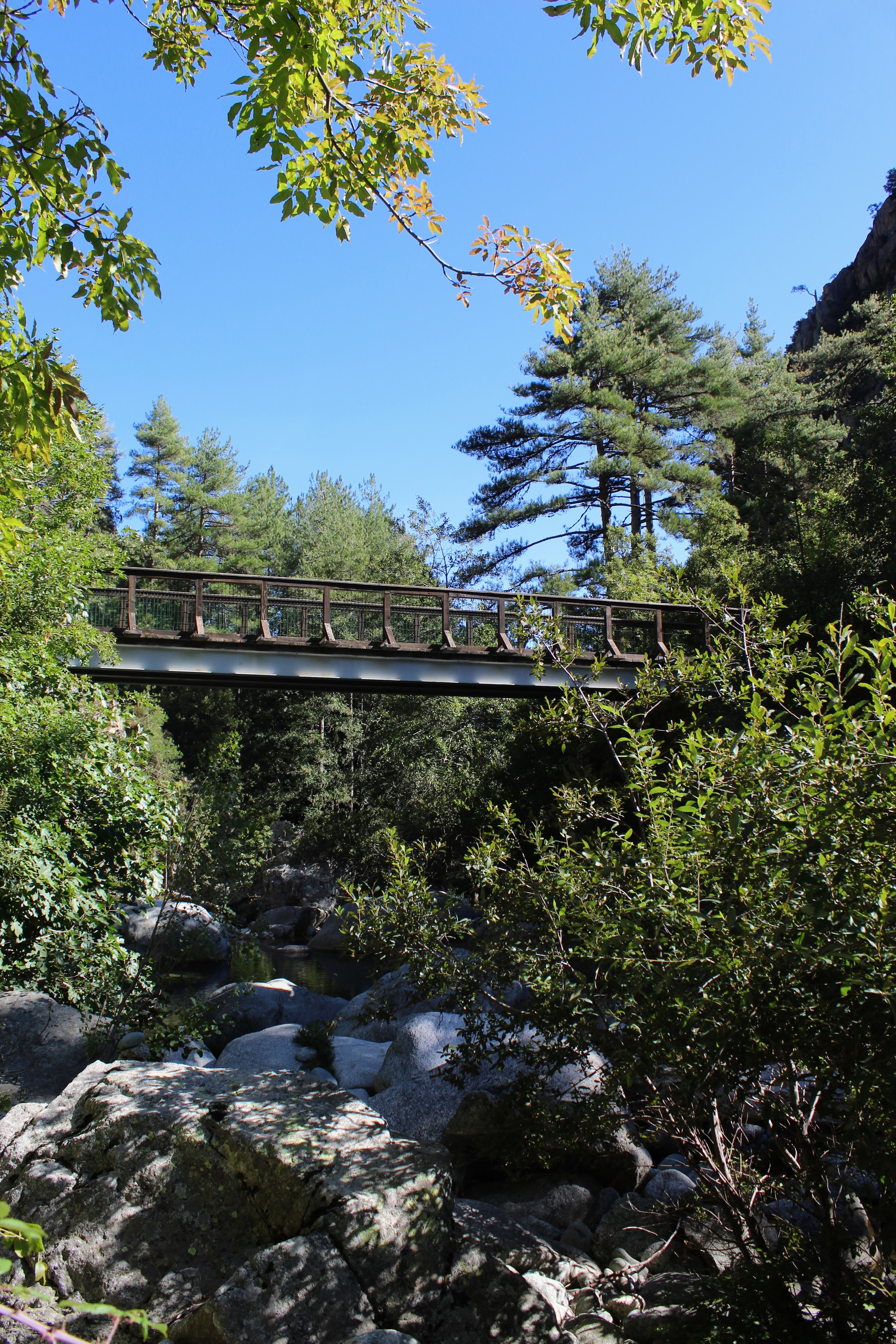
Continuing on, the paved path is bordered by high cliffs on the right, you will be about 50 mins away from the suspension footbridge. The path sits high about the gorge with fantastic views. Once at the bridge, marked Plle 760m alt on your maps, you will find a spring, situated several metres further above the path, on the right, you will see a pipe and spring water. If you cross over the footbridge a path on your left leads down to smooth rocks and a large pool.
- Pasarelle Russulinu (to Corte) 2h30 / 6.25km
Retrace your route back to CORTE.


