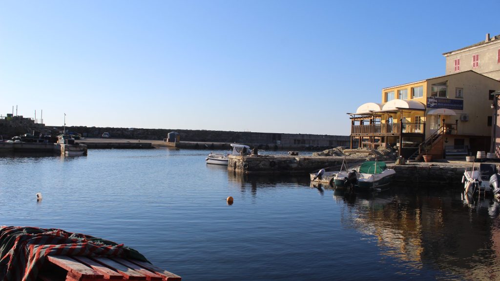
From the fishing harbour at Centuri, to the ridge that defines the Cap Corse, chapel to chapel, tower to tower.
A village to village walk, from chapel to chapel, tower to tower sublime coastal walking then a lofty ridge walk.
Food supplies: CENTURI.
13.5km / 5h00 / +900m / -500m
- Centuri (to Track junction alt pt 59) 0h30 / 2km
With your back to Hôtel de la Jetée, continue on the road south passing the rough parking area. Cross the grassy Conservatoire du littorale area, and rejoin the road, after a few metres drop down through a gap in the wall onto the pebble beach, and cross this climbing again to the road at the seaside hamlet of MUTE.
Enter the hamlet and take the lane between the first house and the sea and pass in between the houses at the hamlet and harbour. Bear left at the open area and rejoin the road via the steps. Cross the roadbridge on your right and continue following the road, passing the campsite. (NB After 200m on your left a path drops down into woodland (signposted PECORILE) which is another route to point * below). Continue along the road, turn right on a rocky track 750m after the campsite (alt pt 59).
- Track junction alt pt 59 (to Pecorile) 0h45 / 2km
Walk along the rocky track. After 350m leave the track as it becomes a grassy path, passing parallel to a stone hut with a rusty metal tank, continue ahead, climbing through messy gardens, under trees. The path continues to climb around Monte Rossu. You soon reach a more exposed rocky section, around the MONTE ROSSU. The path again enters low maquis and continues a gentle climb to the old windmills. Continue passing the last windmill (which is on your right), the path opens up again with views of the coast to your right. Ignore any paths that drop down to the coast and 300m after the windmill you come to the road (and the point *) FOR A SHORTER WALK, loop back from here.
From here the path again heads off to the right signposted PECORILE, the views are again sublime. The path rejoins the road just before the private square PISAN tower gates and continues along this for 500m.
- Pecorile (to Possace) 0h30 / 1km
After a large MAISON AMERICAINE on your right, and the white and blue CHAPEL to your left, take the concrete lane straight ahead dropping down below the road and passing two villas. Continue straight on as the concrete lane changes to a dirt lane. (some building work in field on the left pass this). At the stone buildings, turn left, heading up between the drystone walls. Ignore a path that comes in from the left (signposted STANTI) as the path opens from woodland, continuing straight ahead and after the vines, take a distinct right that continues along the vineyard boundary, then climbing to the road at D80 at MORSIGLIA.
Cross the D80 road, heading along the road that gently rises behind the stone hut CLOS PAOLI, passing the RECYCLING POINT towards the chapel and at the vineyard boundary, take the path to the left signposted POSACCE.
After 50m, at the second sign (near white washed tombs) turn left (ignoring the sign for POSACCE which continues straight ahead), climb into the woodland cemetery tombs, the path becomes stone cobbles, and climbs to a cross at the church at POSACCE.


- Possace (to Notre Dame des Graces) 0h45 / 2km
Walk between the EGLISE ST CYPRIEN and the CHAPELLE STE CROIX, turn right after the chapel along a grassy lane, then left take the climbing path between tombs before leaving the cemetery behind at the last tombs and heading to the D35 road. Head straight ahead along the road and head left up the concrete track almost immediately. Keep straight on climbing with the villa entrance on your right. Head into the trees along the woodland path and start the climb which is soft underfoot all the way to NOTRE DAME DES GRACES. Ignore a sign on your left for PRUGNA and continue heading up through the trees following the path. You soon see a water pipe that you follow all the way to come to the chapel Notre Dâme des Grâces. Continue right along the track to the road.
- Notre dame des Graces (to the Col de Santa Lucia)2h00 / 6km
At the road, turn right and walk for 150m. Turn left, follow the track for 300m. At the second bend take the path that goes straight along the ridge line. After 50m, follow the path that goes up on the right. The path follows the ridge, then descends and stays on the same contour level to pass beneath the Punta di Fornellu. You join the ridge, before dropping down into the valley which you traverse at the same contour level before heading out of it along a track. At the track, turn right and go up towards the Punta di Gulfidoni 606m, continue for 500m to a crossing. Take the track on your left and follow the ridge to the Punta di a Filetta Suprana 590m. From this point, the path descends along the ridge. You will come to a small wooded col, head left. After 10 minutes you will come to the road and the col Santa Lucia at 381m.
- Col de Santa Lucia (to the gîte de Sénèque)0h20 /1km
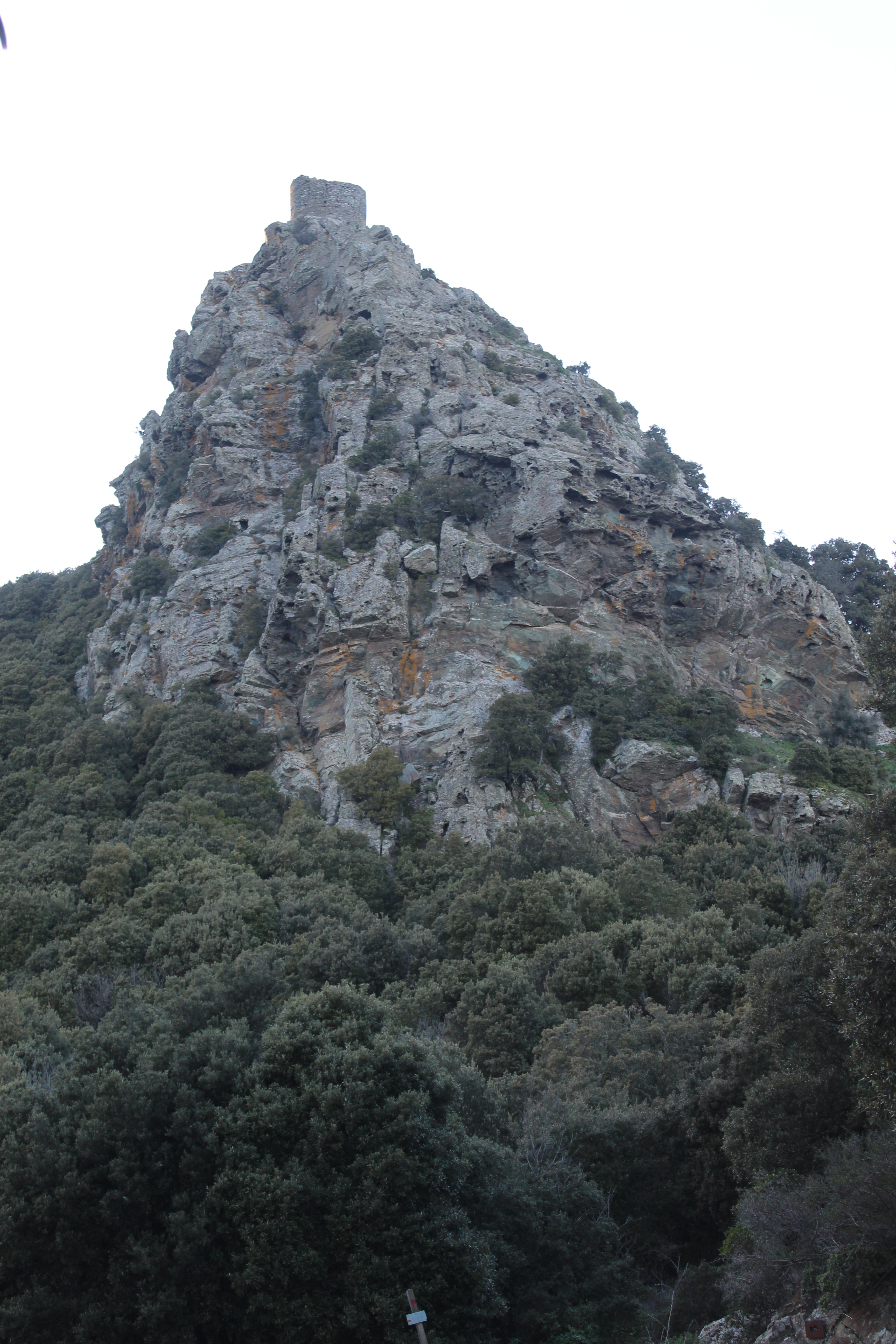
Cross the road, take the road that climbs alongside the chapel heading towards the old convent. Follow signs for the tower off to the left to climb, cutting out the hairpins in the road.
- Gîte de Sénèque