Into the heart of the Vallée du Fangu, along mountain paths and transhumance trails. This walk is a contrast to other walks in the Balagne, from a ruined village, to woodland trails and balcony paths, the crescendo is the fabulous Fangu river, ideal for a spot of bathing in one of the natural pools.
From the bridge at TUARELLI and the Mare e Monti path, this walk climbs steeply to the abandonned village of Prunniciale then onto MANSO, a hamlet in the shadows of the PAGLIA ORBA, Corsica’s second highest peak and perhaps the most recognisable. From MANSO, walk alongside the river all the way back to your starting point.
Great mountain and riverside walking in the Fango Valley
8.5km / 3h00 / +245m / -245m, ORANGE /YELLOW / Provisions in CALVI / GALERIA
- Tuarelli bridge (to Biluga stream) 0h45 / 1.5km
Starting from the parking area on the Fango Valley road, cross the Tuarelli bridge over the Fango River. Take the paved road to the right after the bridge, and after 100 meters, turn right again. Initially, follow the orange markers of the Mare e Monti long-distance hiking trail. After another 100 meters, you will see the Mare e Monti trail ascending the embankment to your left, along with a sign indicating Bonifatu & Calenzana / Pruniciale Loop. The wide path climbs gradually through the maquis shrubland.
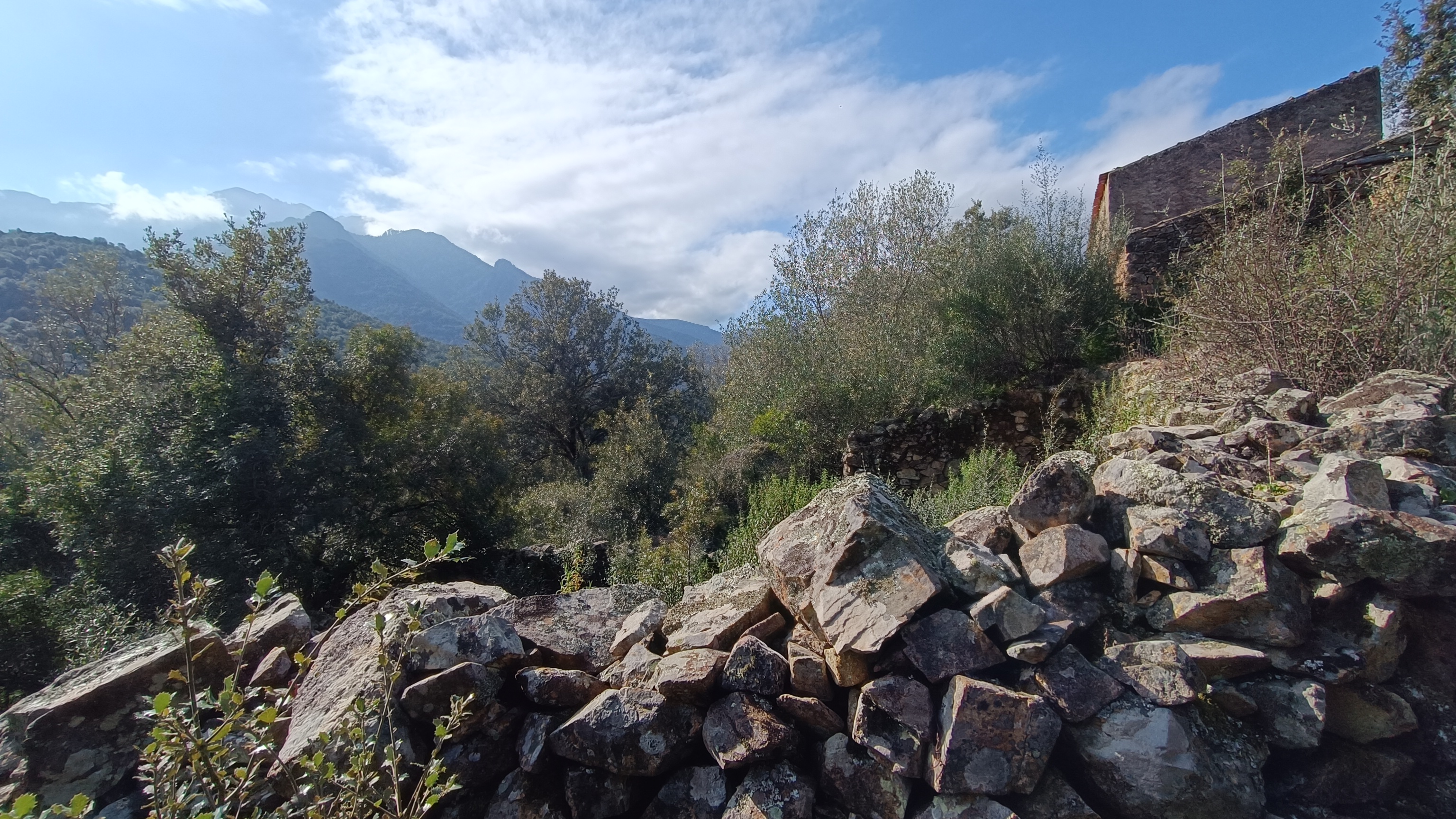
After 600 meters, you will reach a trail junction. Leave the orange Mare e Monti markers and follow the narrower path to the right, marked in yellow, towards U Mansu / Pruniciale Loop. The path descends slightly and then climbs through dense maquis shrubland until you reach the abandoned hamlet of Pruniciale. Follow the path that descends to the right beneath a large ruined house; you will pass a bread oven. The ruins can be explored with caution by the more adventurous. From there, descend along the path bordered by a dry-stone wall to the BULIGA stream (ford crossing).
- Buliga stream (to Manso bridge) 1h30/ 3.75km
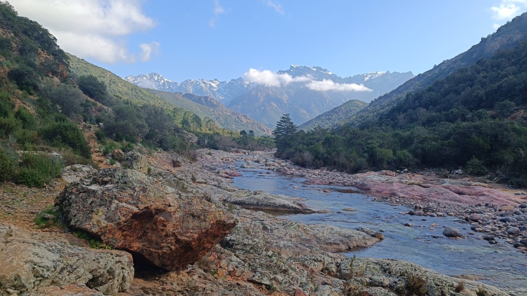
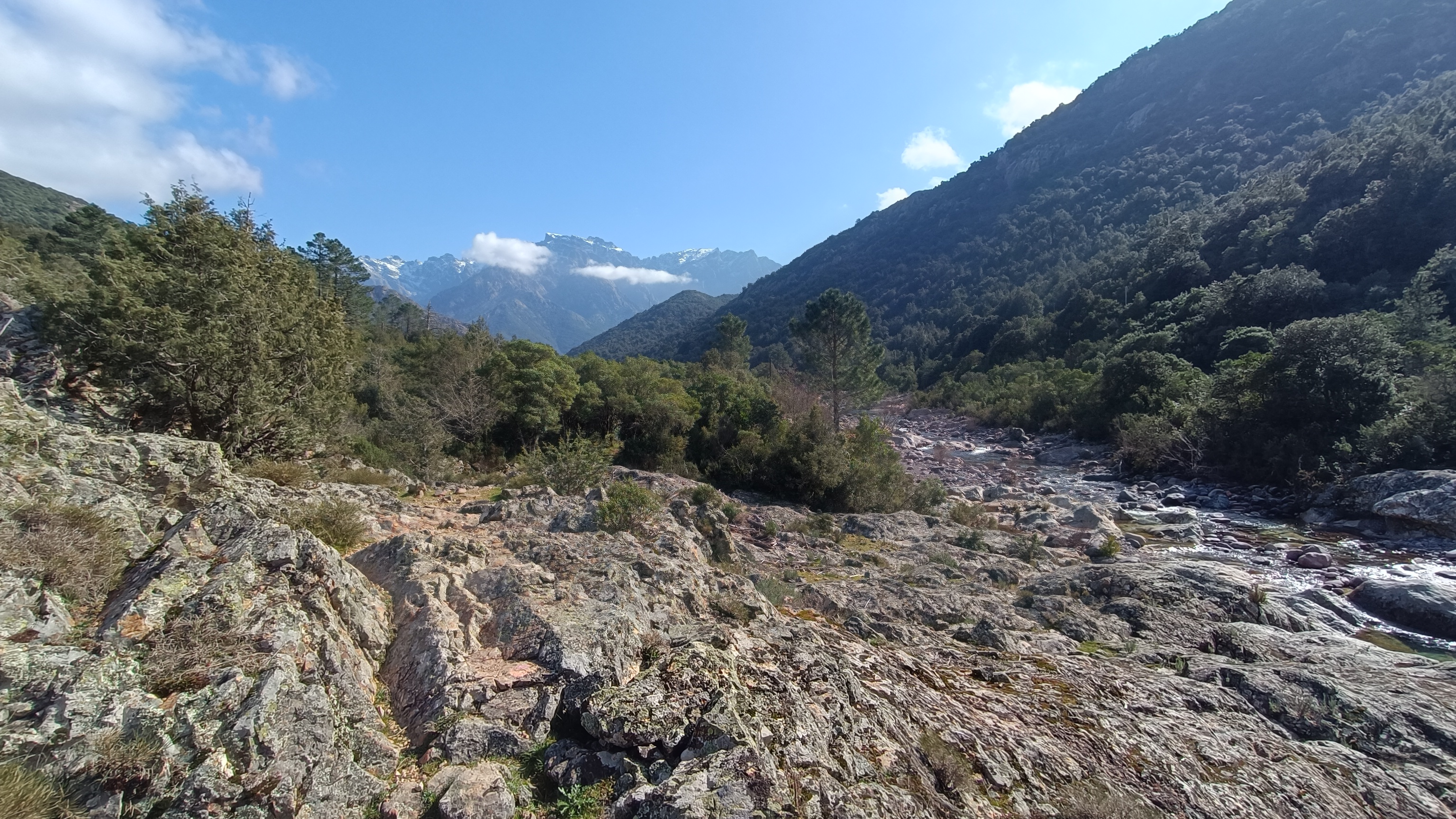
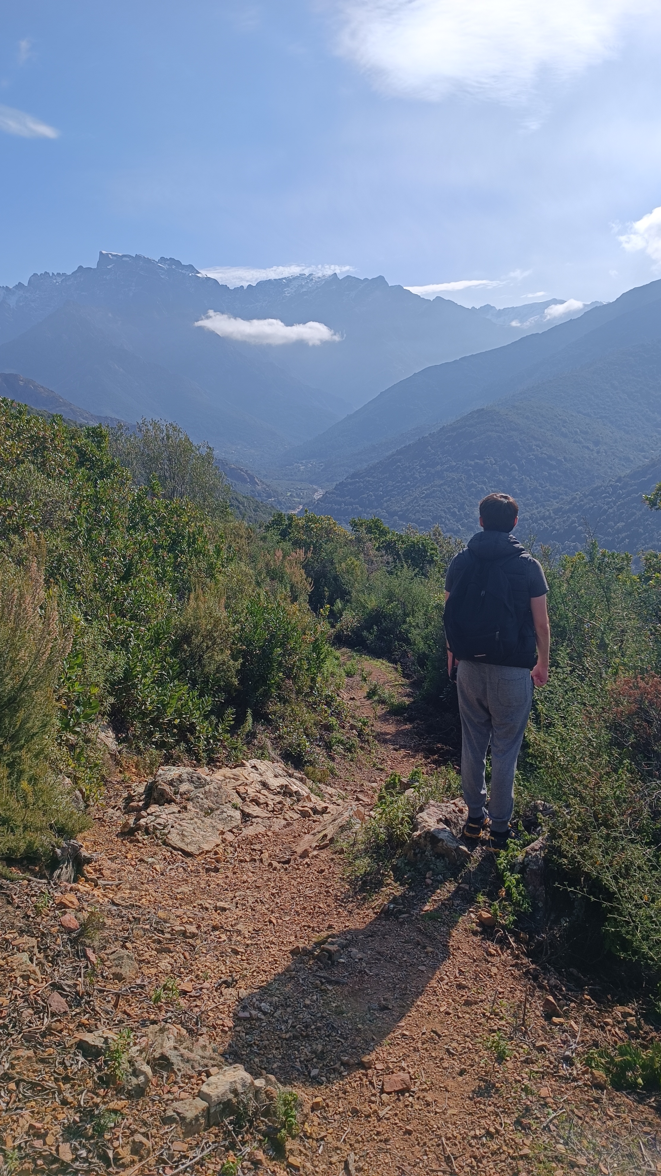
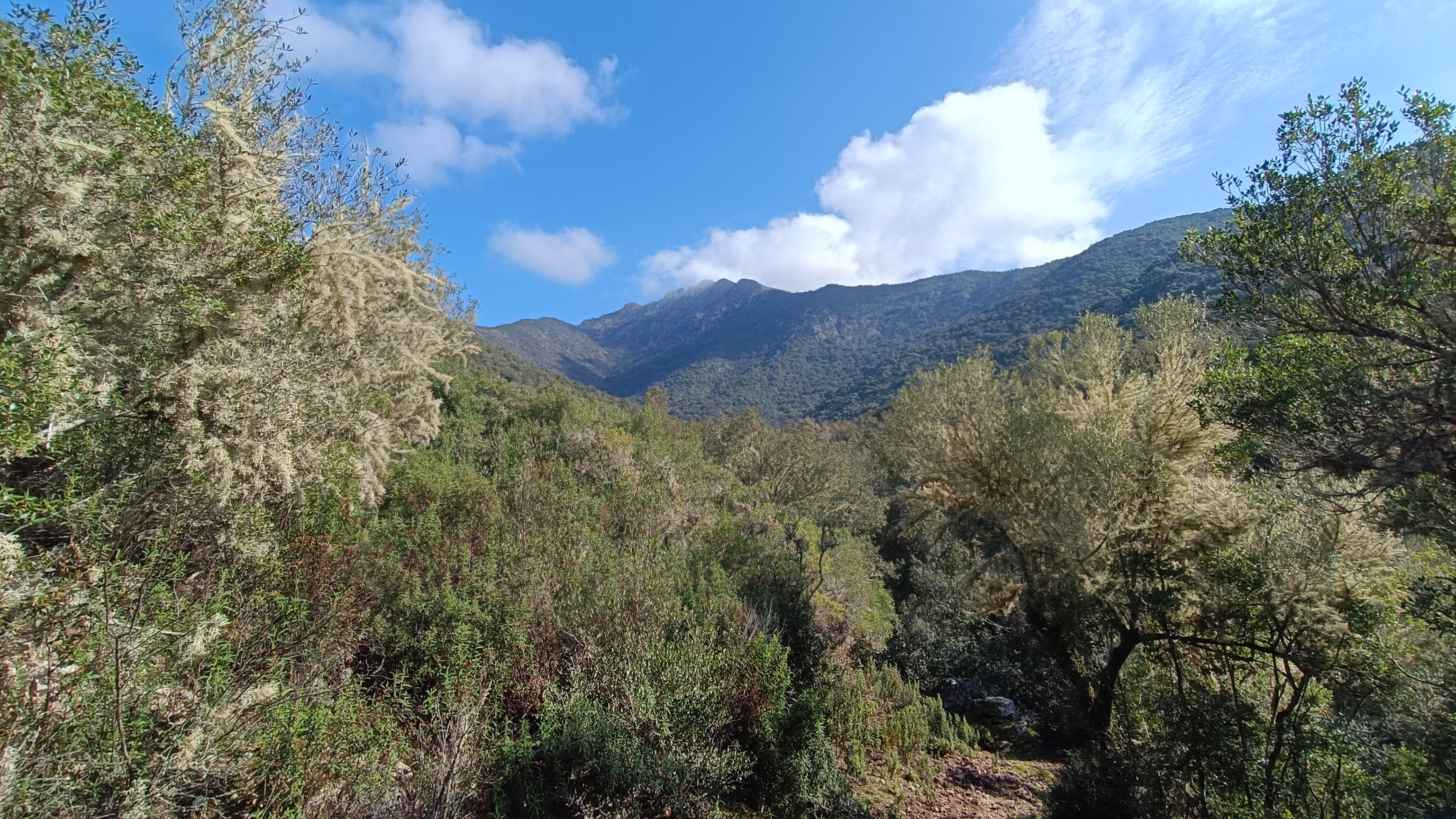
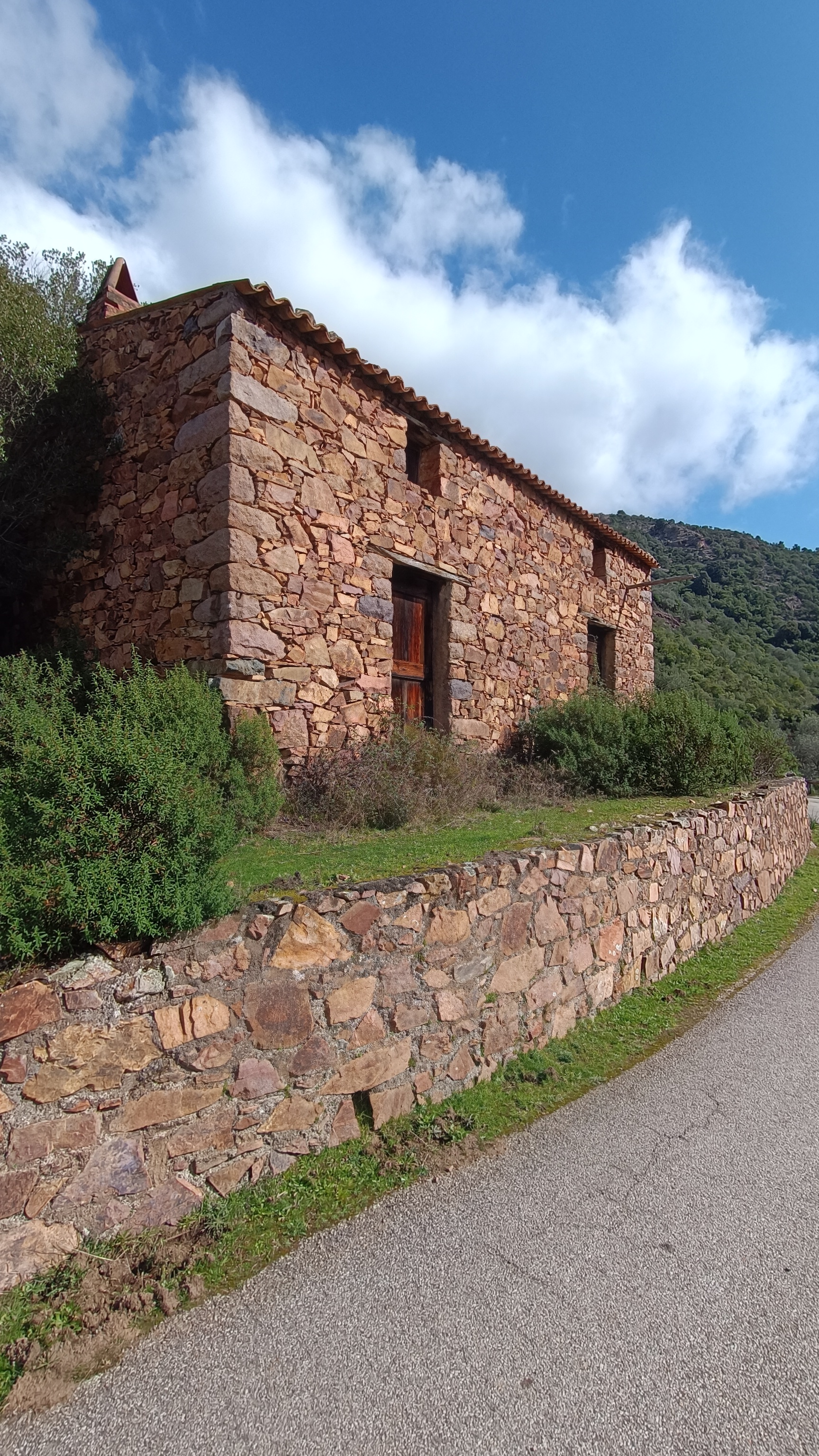
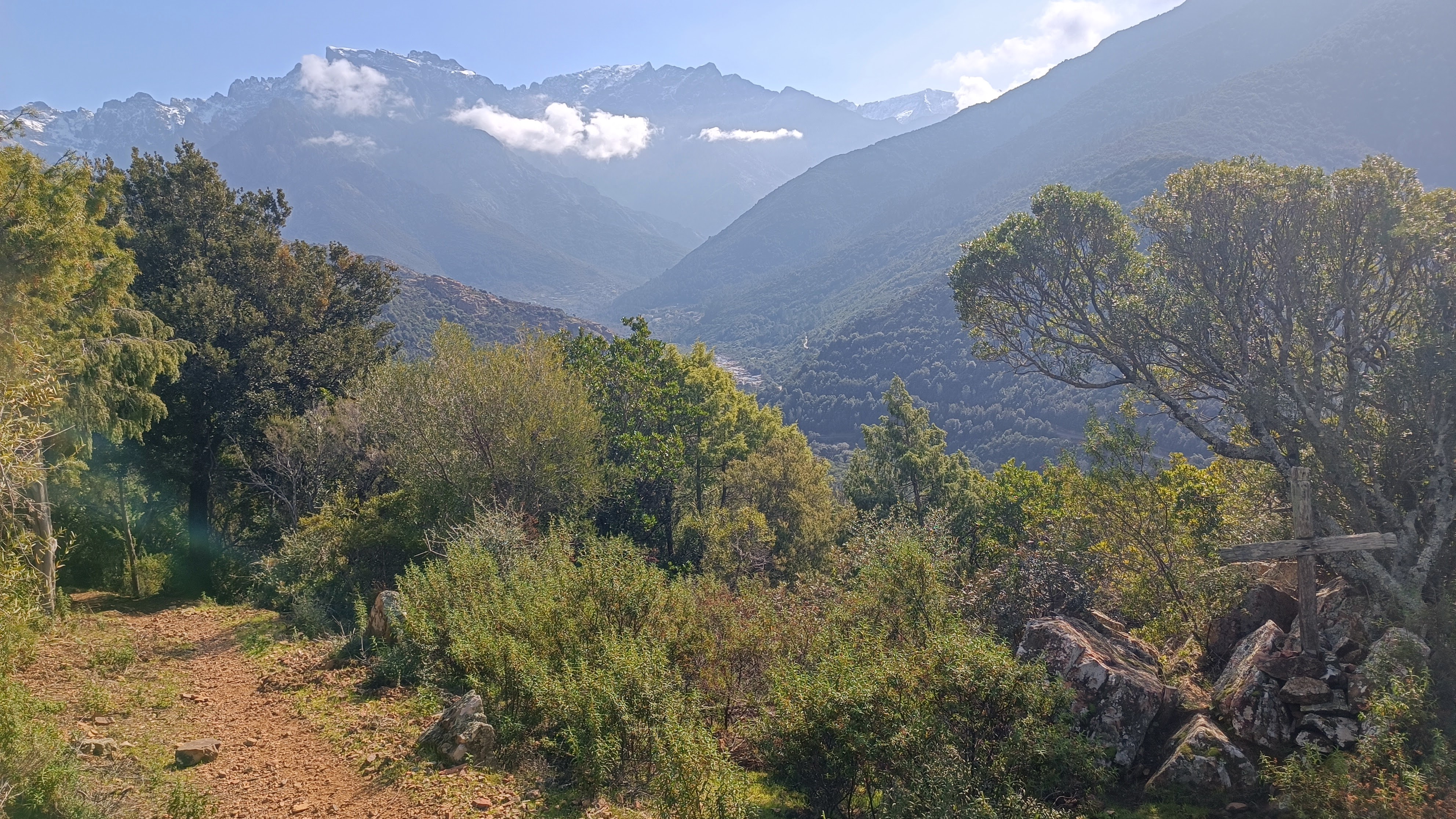
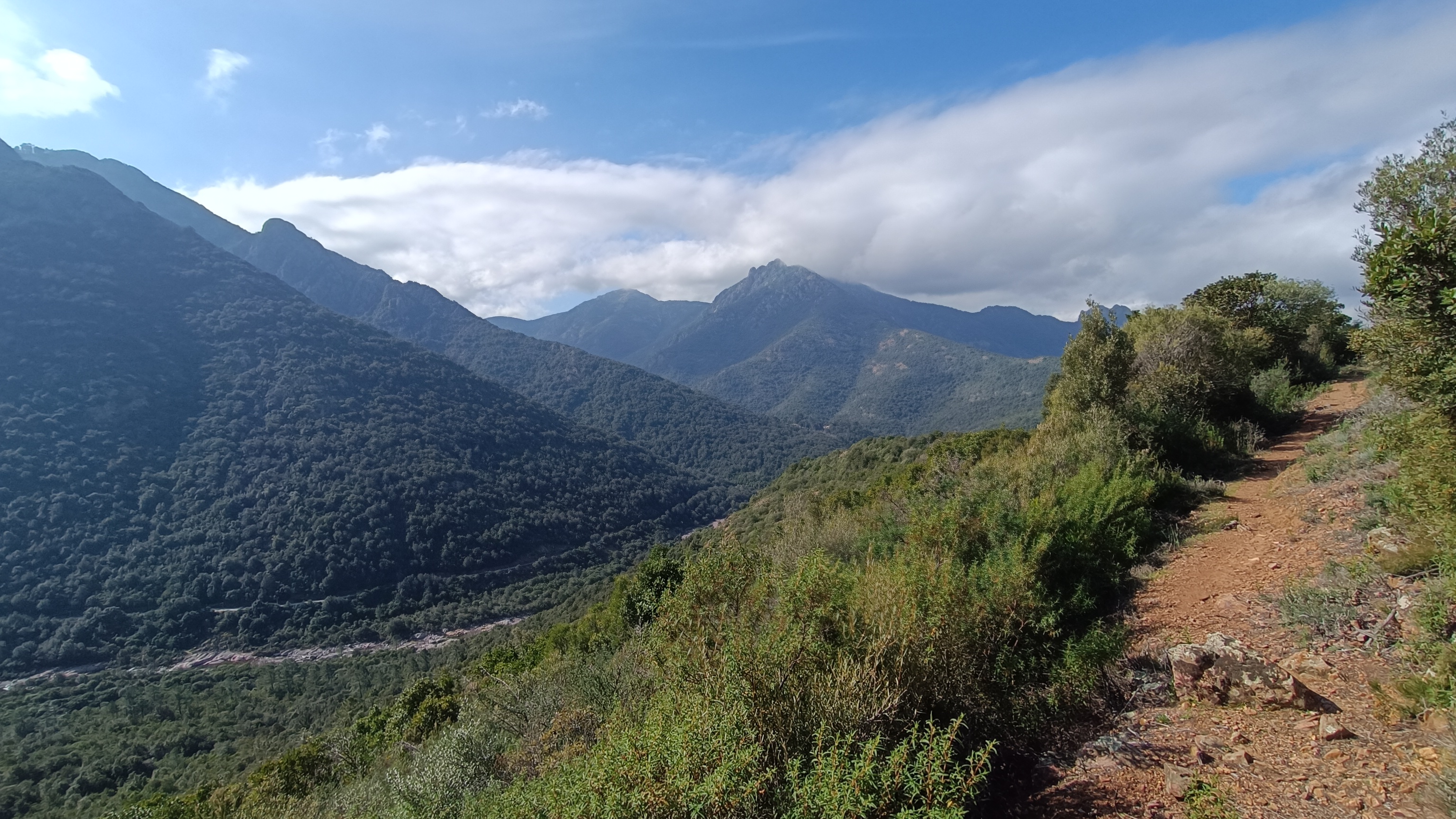
After crossing the stream, the path climbs steeply for about 700 meters through a dense, dark forest of holm oaks, junipers, and strawberry trees. After the climb, you reach a chestnut grove with a view towards the sea, then the SAN GHJORGHJU ridge. Here, a beautiful panorama unfolds over the FANGO valley, from the upper valley and the hamlets of MONT ESTREMU and BARGHJANA, dominated by PAGLIA ORBA (2525m), the second highest peak in Corsica, down to the river that flows into the sea in a delta at GALERIA. After the pass, the vegetation changes and the trail enters a low scrubland of rockrose, broom, and holm oak. Descend to a farmhouse located above the village of Manso. Follow a path to the right before the building, and then the occasional yellow markers along the paved road, which loops back through Manso and arrives at the bridge.
- Manso bridge (to Tuarelli bridge) 1h00/ 3.25km
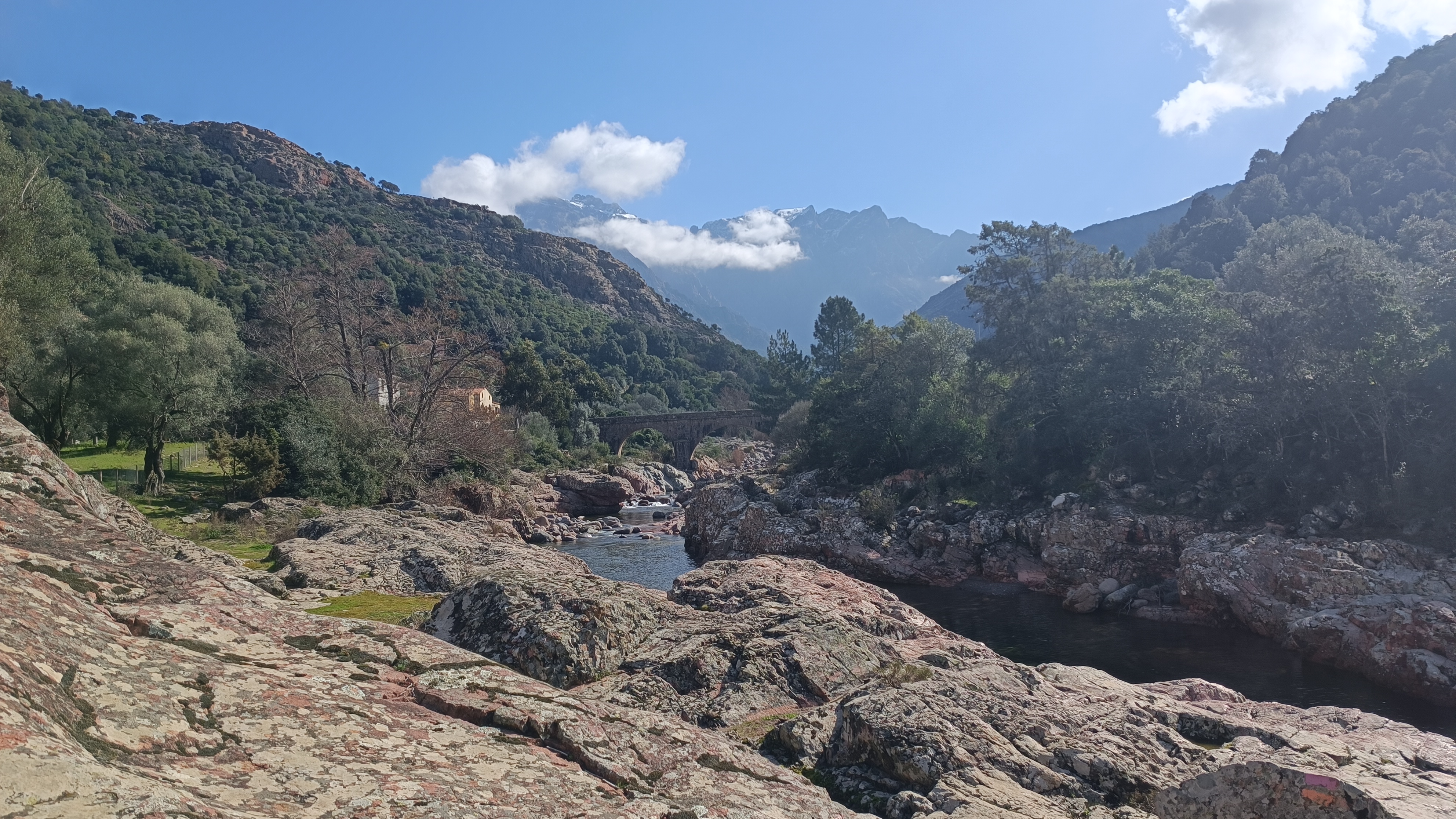
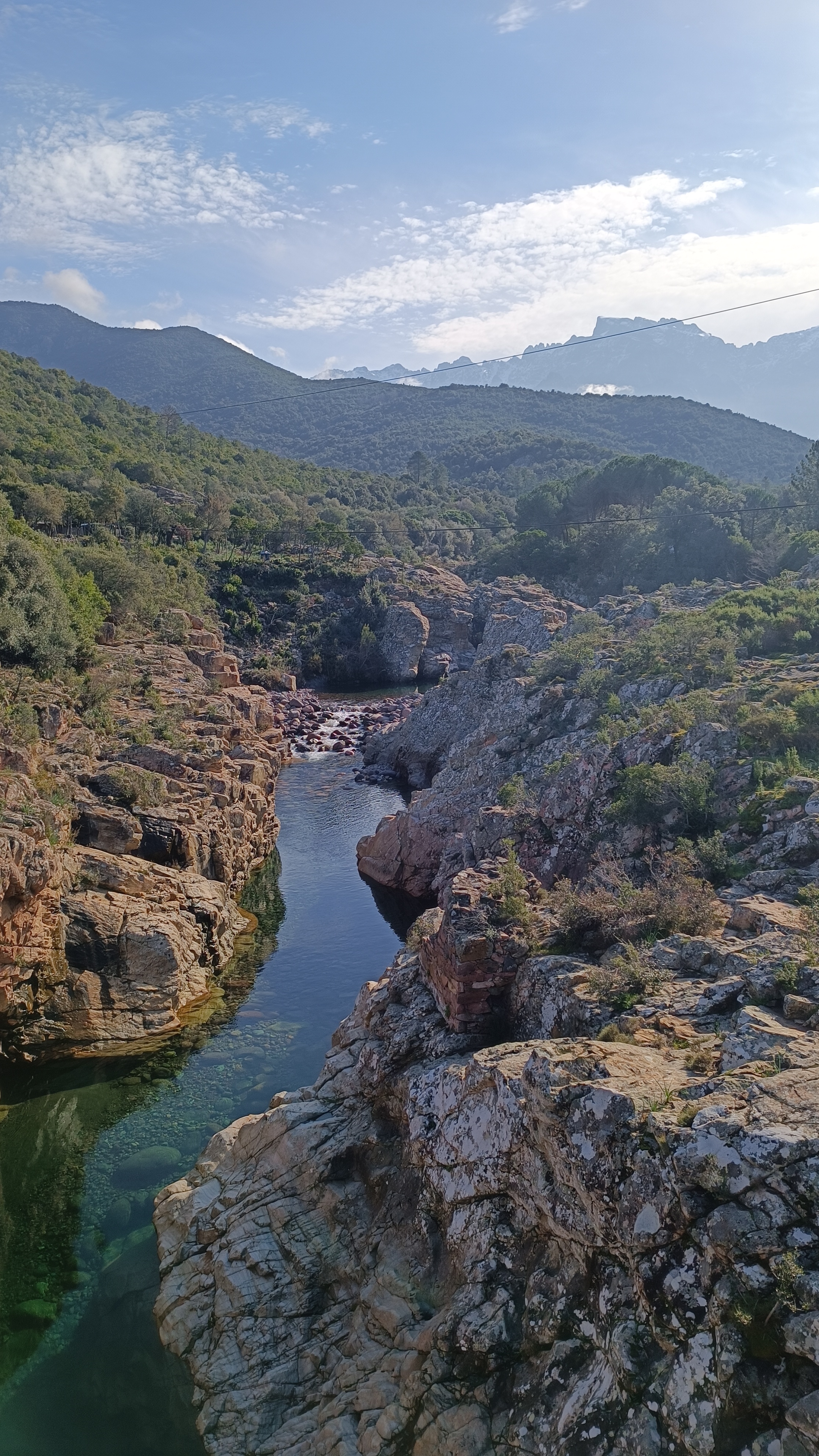
Just before the bridge, turn right following the sign for the Pruniciale and Tuarelli loop. The trail is marked in orange and purple/yellow and follows the Fango River along the rocks (some sections have chains that require your attention). There are many places where it is tempting to swim in the natural pools. The trail was once the old transhumance route from Galeria to Niolu and follows the river, never leaving it for long. A final climb through the juniper, strawberry tree, and holm oak forest takes you past a rocky area, past an old caravan, before descending onto the track leading to the former TUARELLI campsite. You are back at your starting point; follow the paved road to the left and cross the bridge.
EXTENSION: You can extend this walk by starting from the parking area near the Genoese bridge over the Fango River, marked PONTE VECCHIU on the IGN map. Cross the bridge and turn right, following the trail marked in orange, TRA MARE E MONTI, towards TUARELLI. The trail follows the right bank of the Fango to TUARELLI. From the bridge, approximately 2 hours 20 minutes round trip, 8 km.


