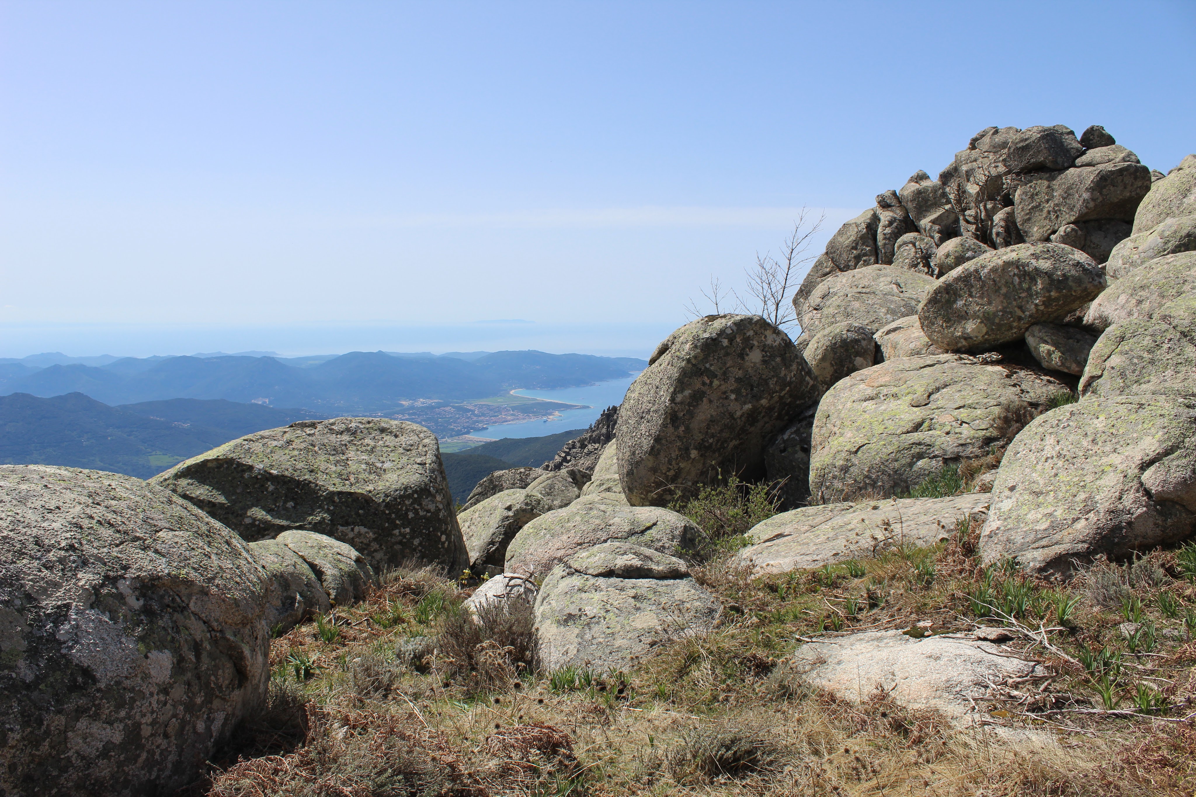
The MONTE SAN PETRU walk explores the highest mountain on the south west coast of Corsica culminating at 1400m. A fabulous ridge walk with views over the Haut Taravo, Alta Rocca, Bavella, and the whole of southern Corsica, it really shouldn’t be missed.
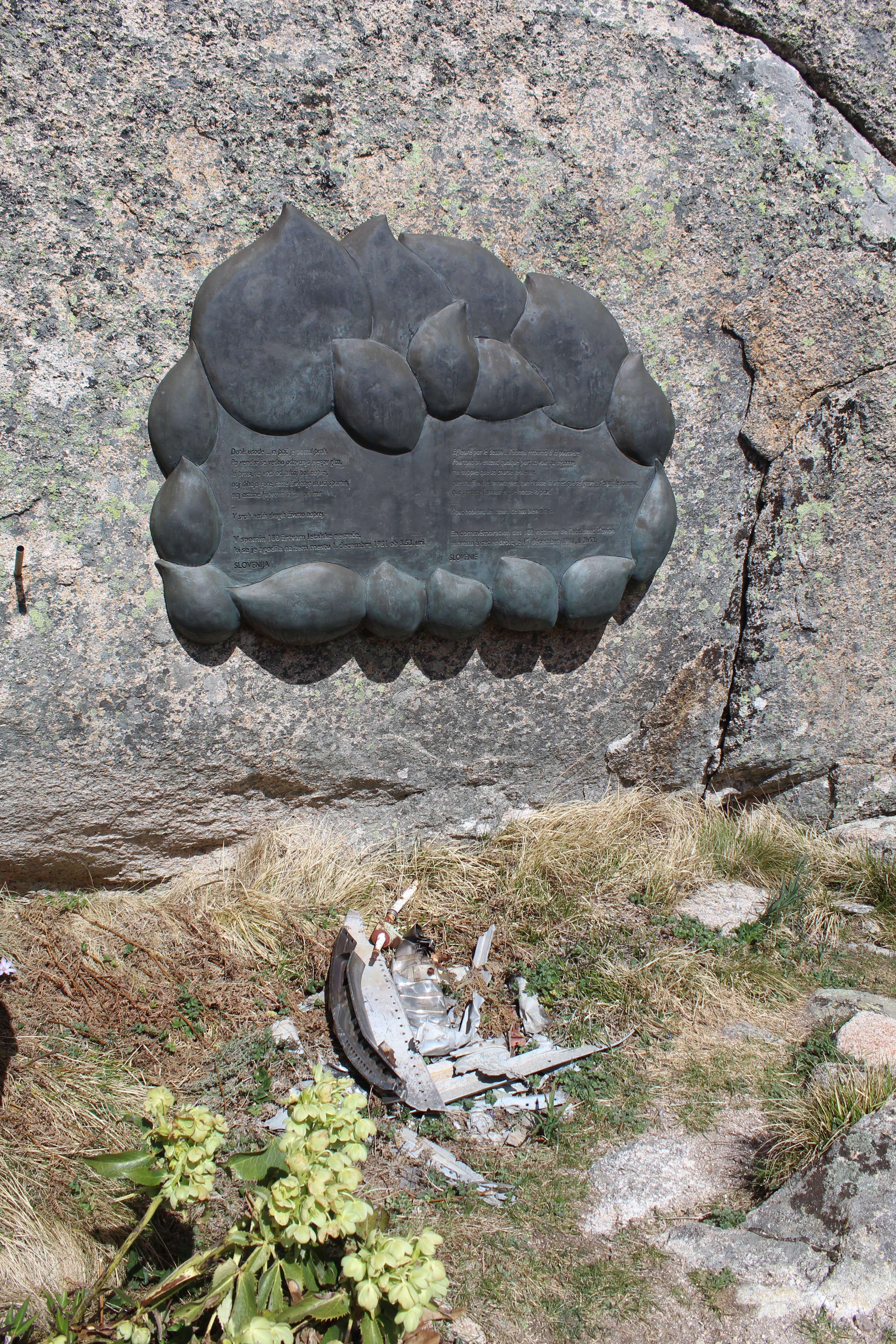
“A summit with views all the way south to Sardinia and north to Piana, and the extremely atmospheric site of a 1981 aircrash where 180 people perished. A poignant memorial to those who lost their lives…”
9km, 3h30, +/- 425m, YELLOW
From the village of PETRETO BICCHISANO, take the D420 signposted to AULLENE /ALTA ROCCA and stop at the COL ST EUSTACHE by the buvette and the cross.
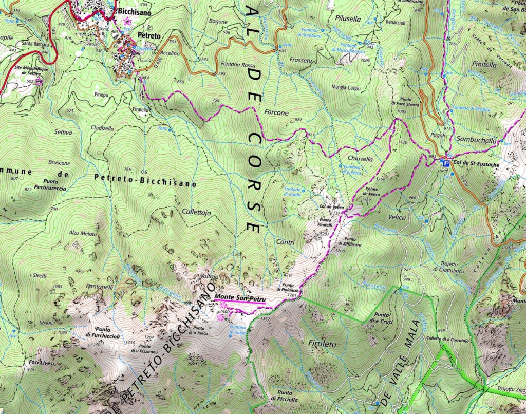
- COL ST EUSTACHE (to COL DE VELICA) 0h45 / 2.0km
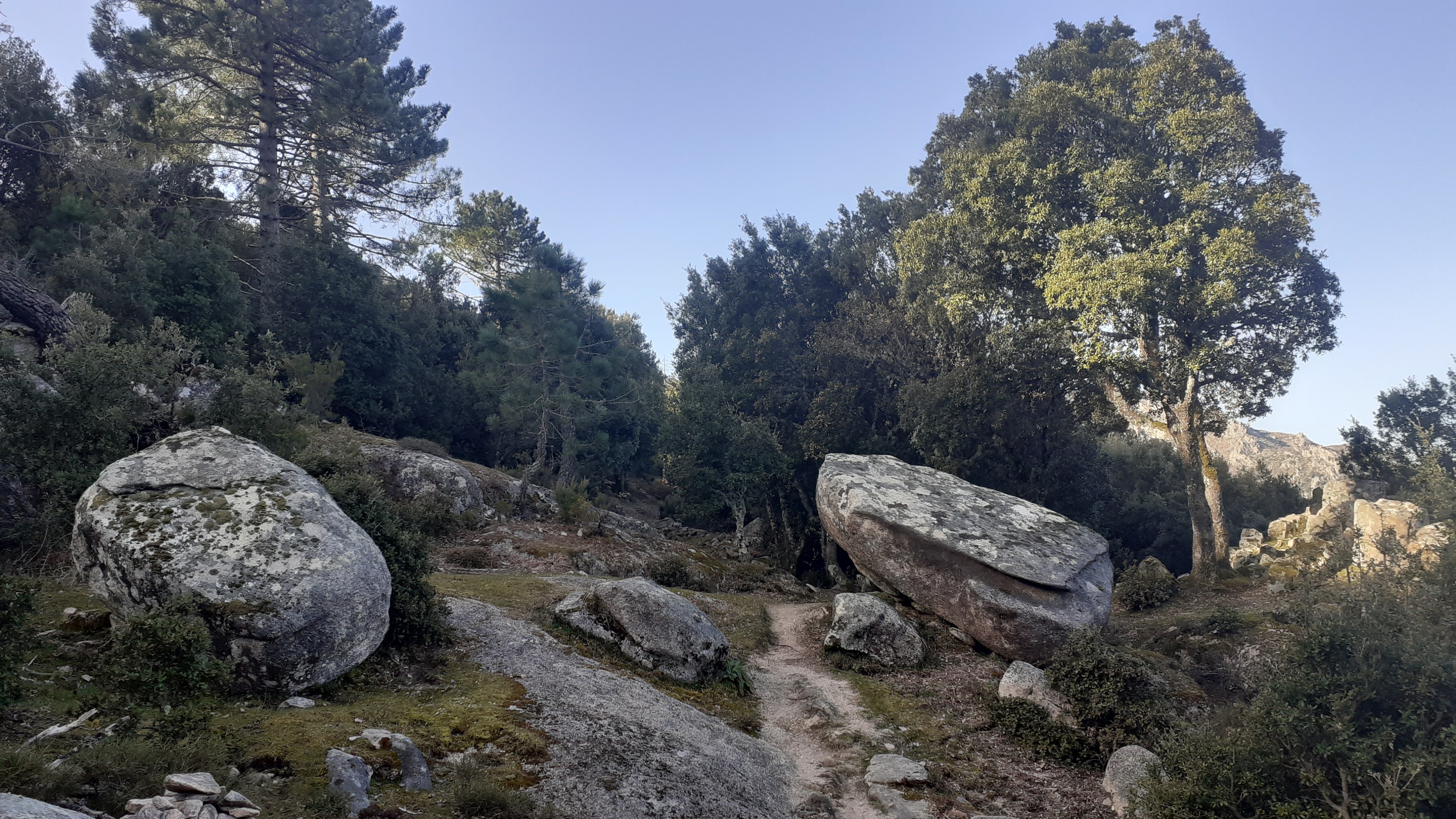
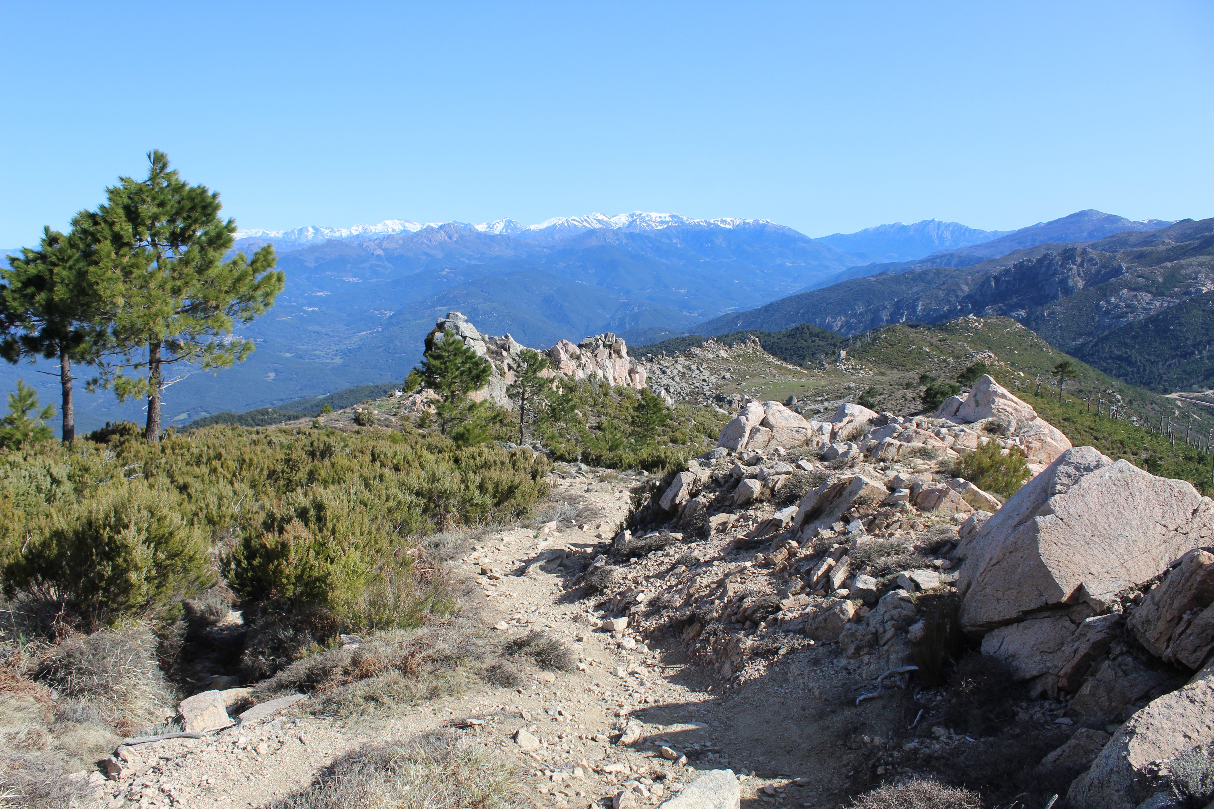
From the COL ST EUSTACHE, facing west with the buvette and the cross on your left, take the large rising track straight ahead past the water tank for 100m before starting your climb on a path to your right at a signpost (no motor vehicules sign). The path begins the climb and, after 650m, reaching a junction (there is a path here that drops down to the village of PETRETO BICHISANO). Here the path turns a distinct left. Continue along the path as it makes a gentle climb initially through woodland, then opening out (a fire ripped over this mountain in 2009 and you can still see the petrified pines), on the righthand side of the ridgeline below PUNTA VELICA. You cross the ridgeline to arrive at the COL DE VELICA.
- COL DE VELICA (to Monte St Petru 1400m) 1h00/ 2.0km
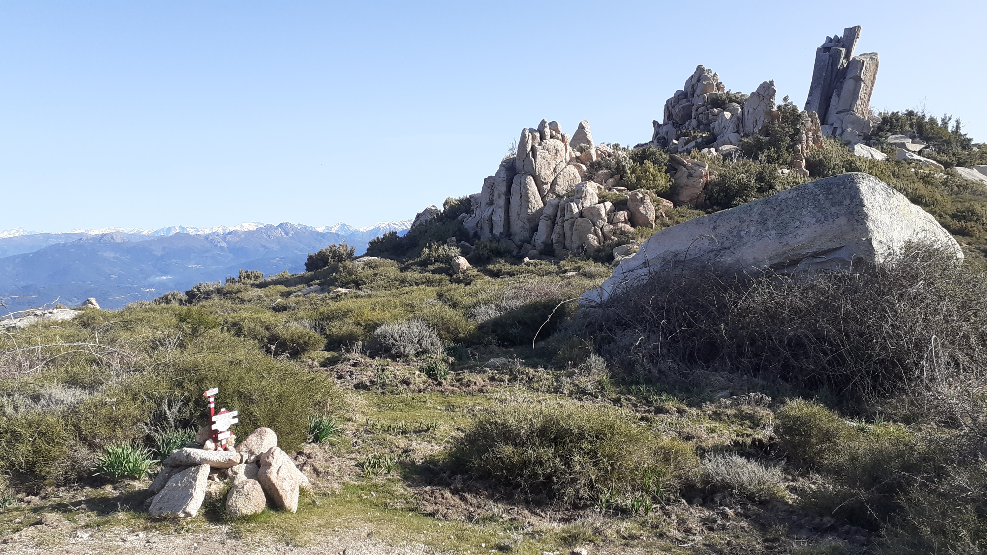
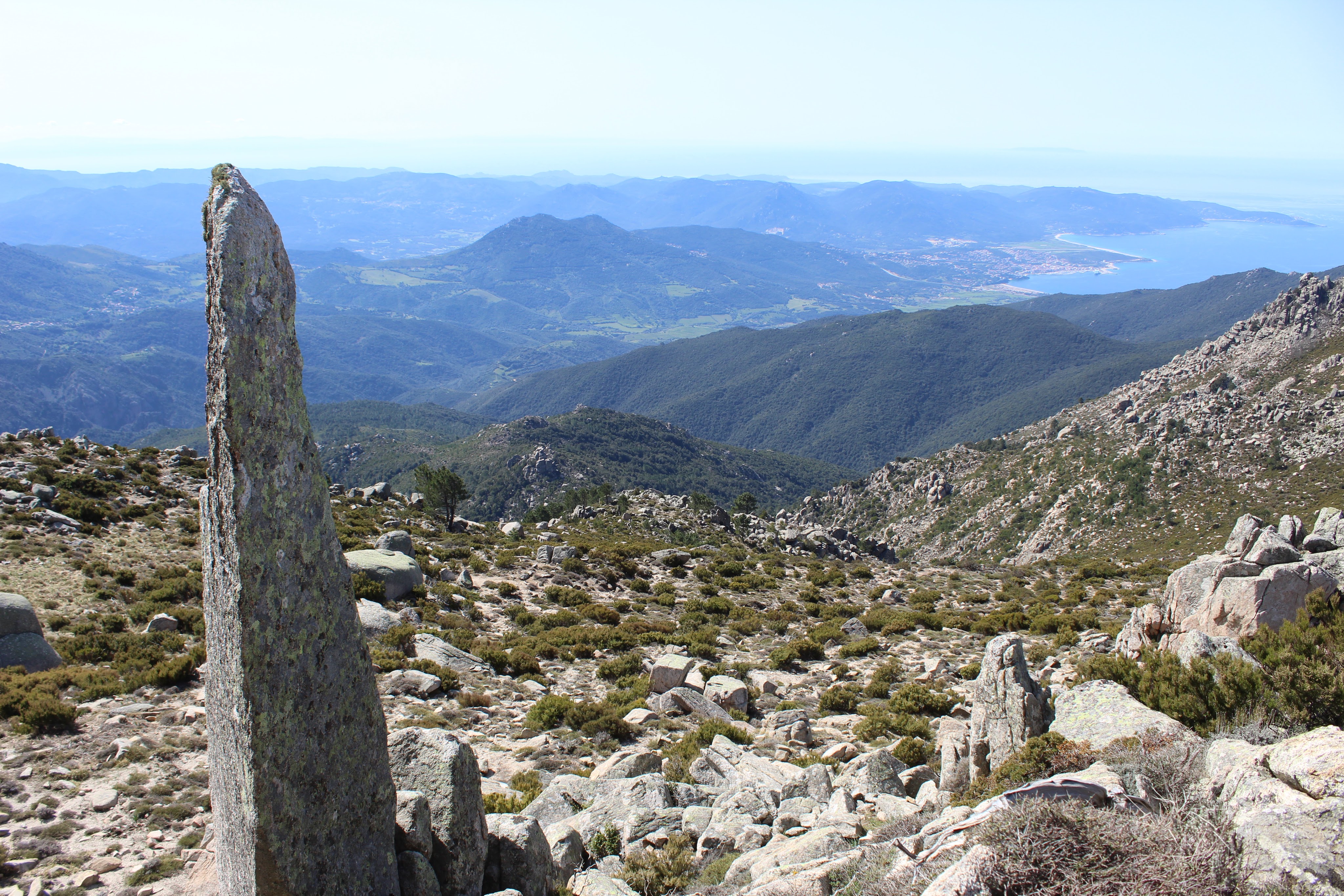
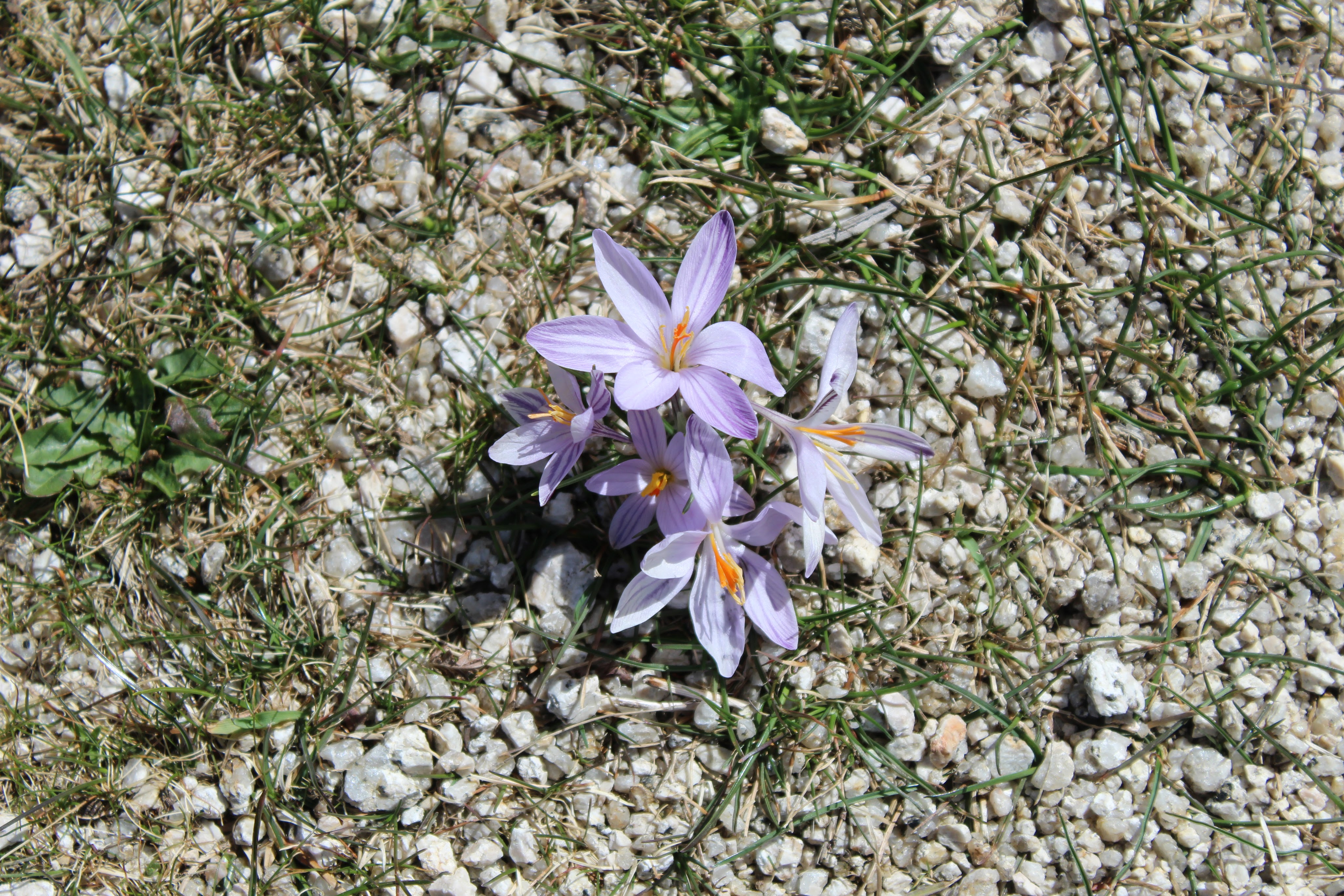
Continue along the well marked climbing path straight ahead, the path flattens at a grassy area, passing between the rocky peaks of PUNTA PINITELLI 1201m (right) and PUNTA ZIFFILICARA 1208m (left). Climbing again, the views open out to the ALTA ROCCA and AIGUILLES DE BAVELLA & L’ALCUDINA, and all the way to AJACCIO on your right. You are now following the ridgeline passing PUNTA DI FOLANCIO 1218m. The landscape is low maquis of broom, heather and immortelle. The path begins another climb off to the right, passing up through boulders before opening up onto a grassy plateau with a chaos of boulders to your right.
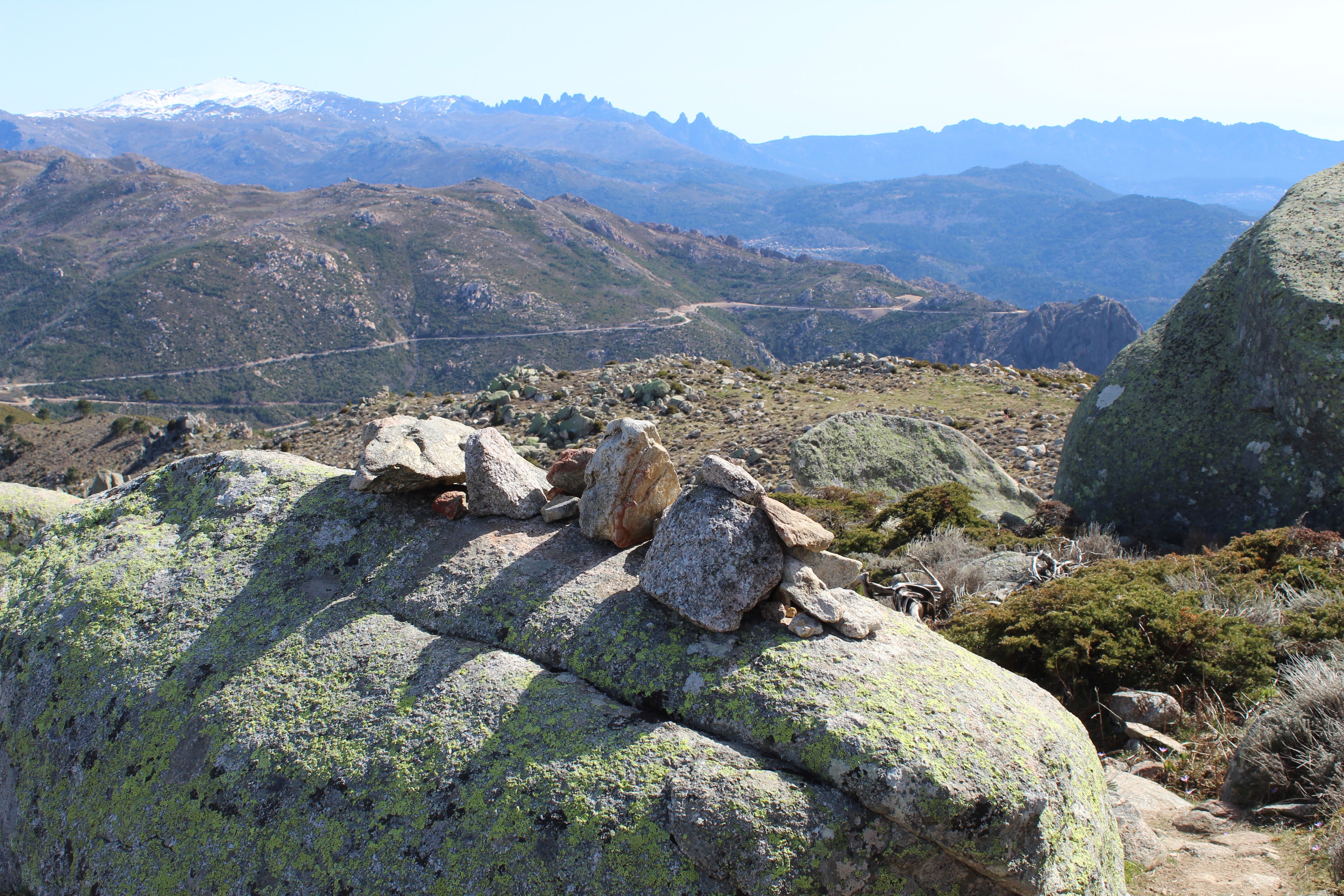
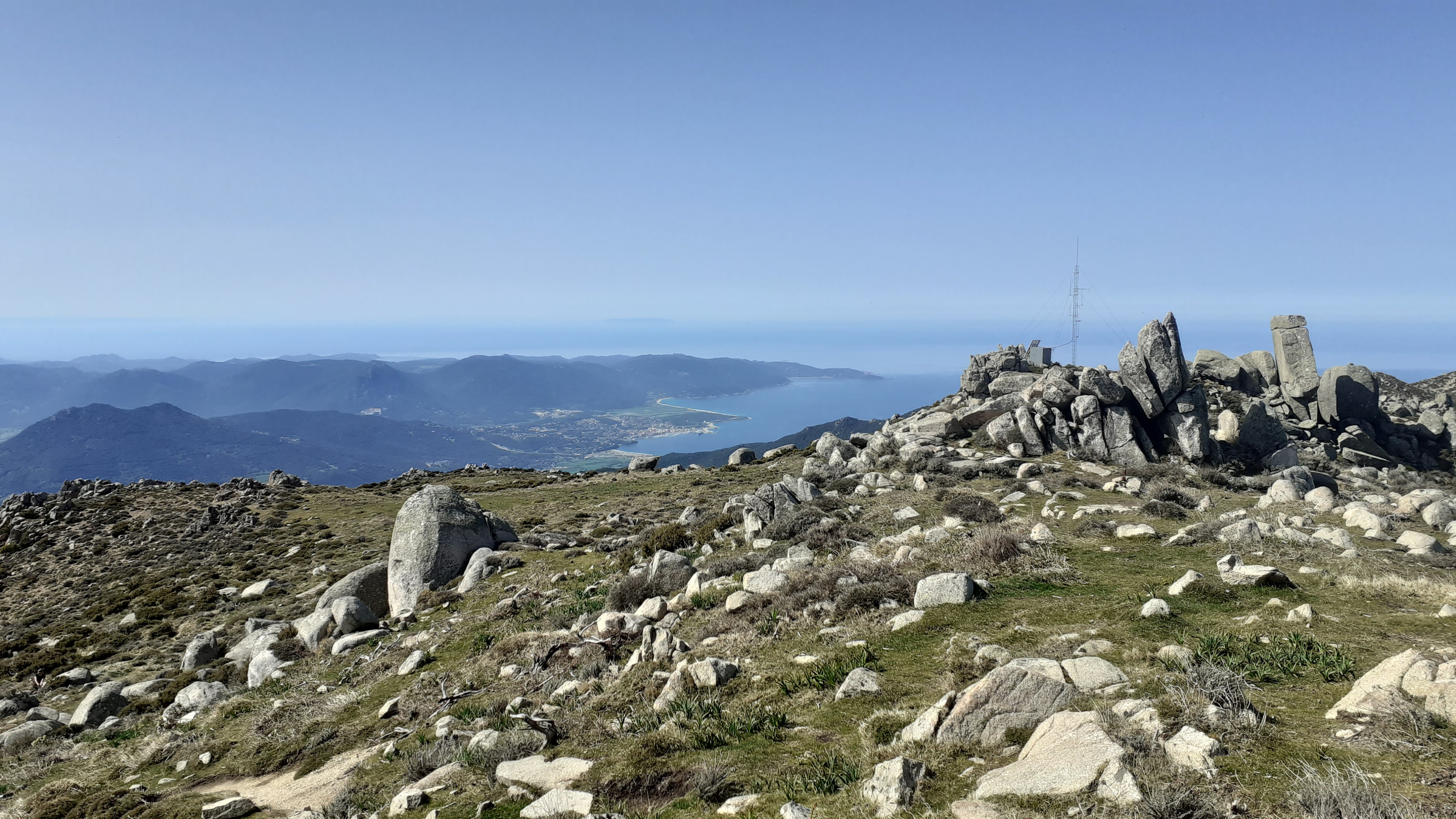
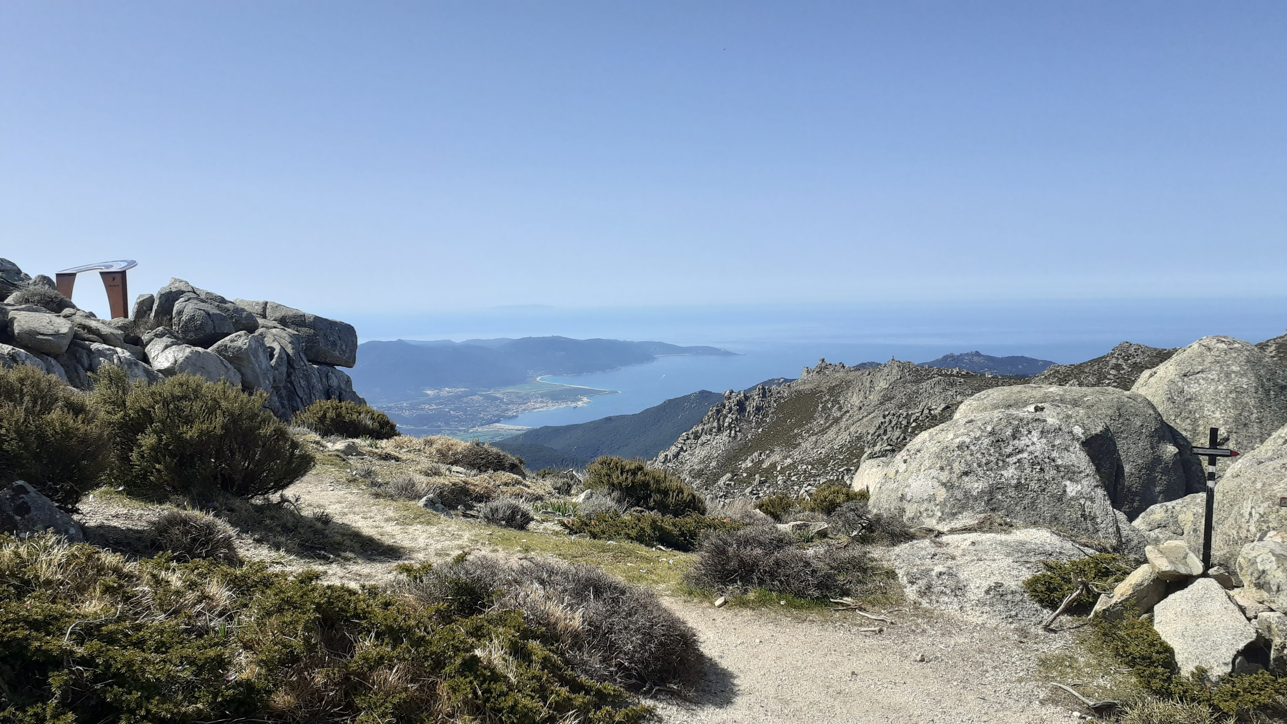
Cross this area, and as the path enters another area of boulders, you see the highest point of the MONTE ST PETRU to your right, and just ahead is a radio mast. You will see a small metal sign (one of many), indicating the summit, turn uphill right here, reaching a small grassy flat area, the rocky summit is ahead of you and the last few metres are a bit of a scramble.
- MONTE ST PETRU 1400m (to Punta di a Junca / Stele) 0h15/0.75km
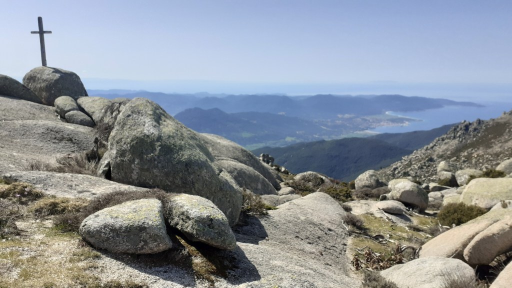
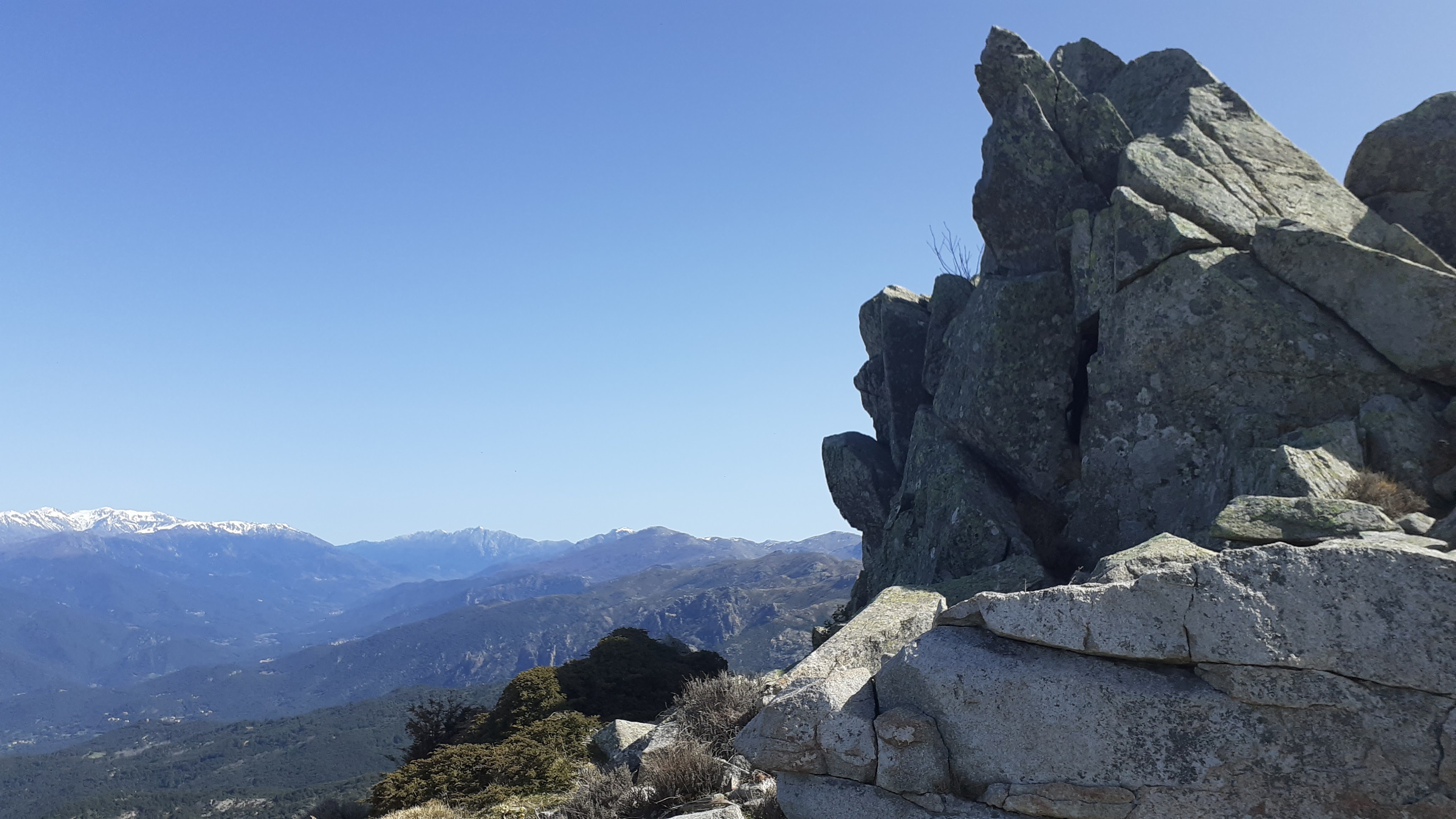
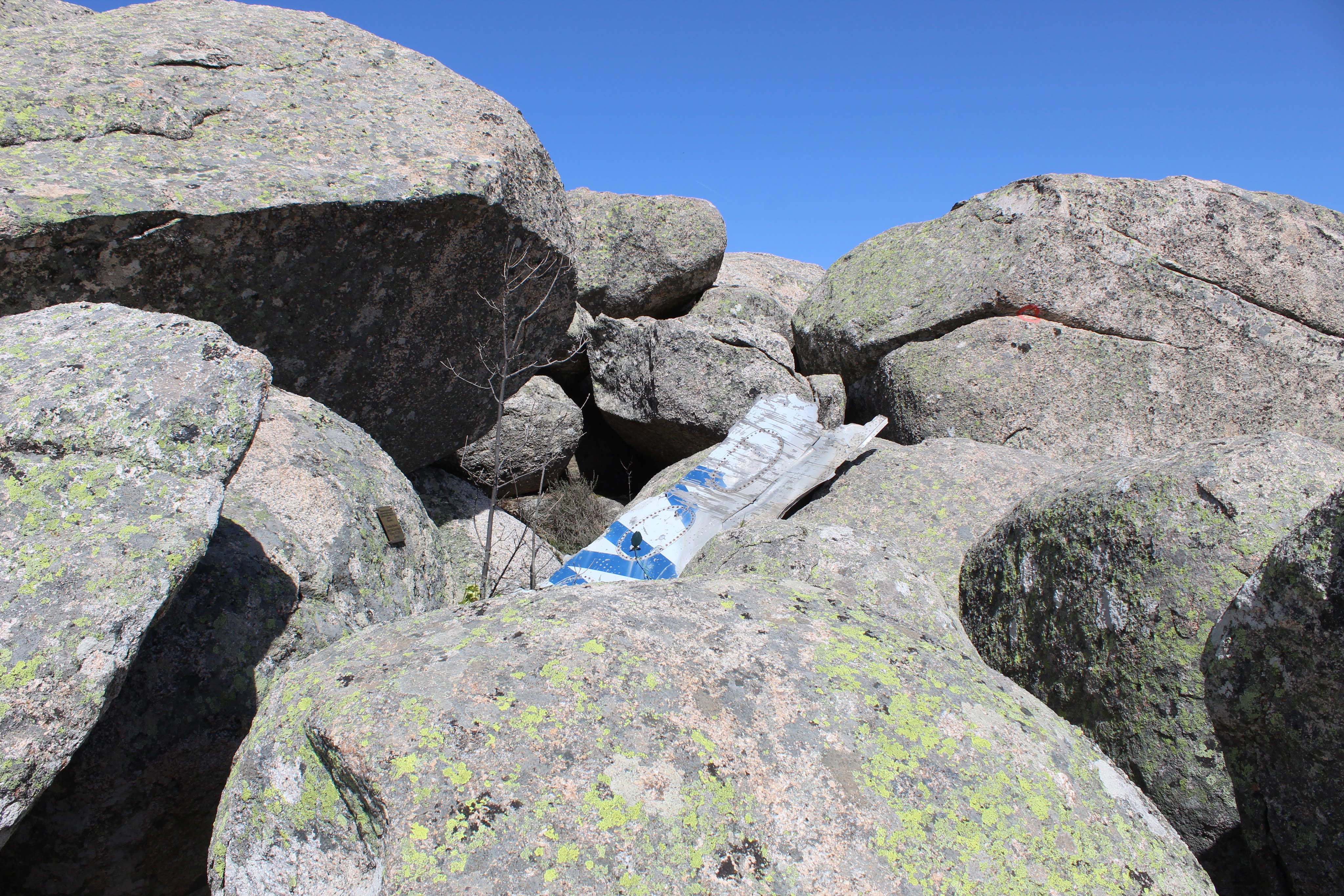
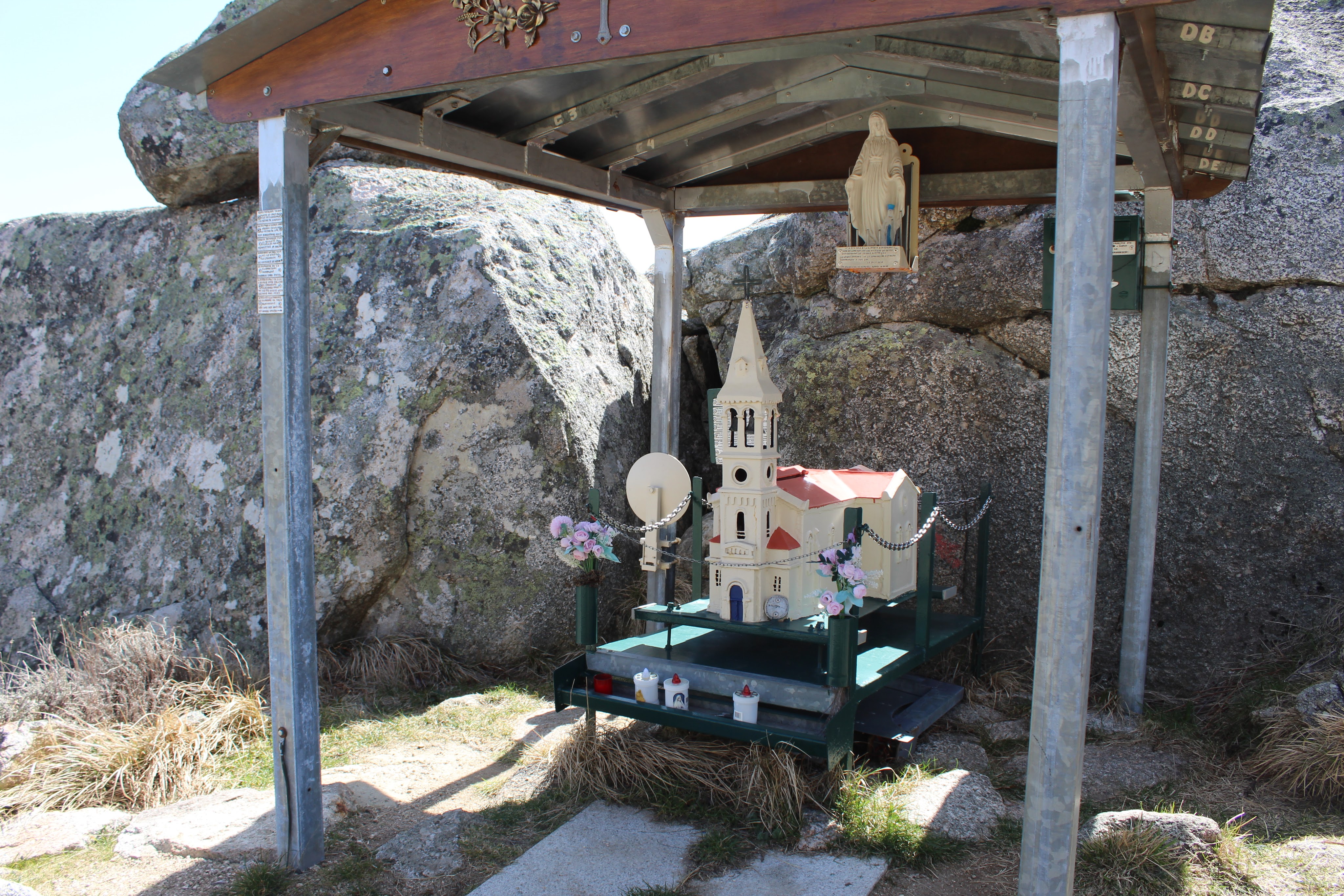
From the grassy area with your back to the rocky summit, head straight ahead along the ridgeline towards the radio mast and hut. There is a panoramic viewing area behind this. From this, continue along the saddle, away from the radio mast, initially across rocky slabs (you will see a cross to your left and a great view over the GOLFE DE VALINCO). The path winds between boulders for 300m before reaching the stele, hidden in the boulders of the PUNTA DI A JUNCA in memoriam of the aircrash in 1981.
Flight 1308, a DC9 of the Yugoslav company Inex-Adria Aviopromet crashed in stormy conditions on the morning of December 1, 1981 against Monte San Petru, killing all of its 180 occupants. The flight left Ljubljana early on December 1 to celebrate a national holiday in Yugoslavia. As it flew over the island, having begun its decent, the plane’s left wing hit the MONTE SAN PETRU at 8:53 a.m. and crashed violently, leaving its occupants no chance of survival.
The investigation revealed that the Yugoslav aircraft had descended too low as a result of communication problems with the control tower at Ajaccio, the control tower at the time was not equipped with radar. A warning signal of the imminent collision with the mountain did sound in the cockpit, but due to some distraction, the crew acted too late to avoid the collision.
Some debris and human remains were removed from the crash site after the accident in 1981. In 2007, a Slovenian TV station did a report on the accident, visiting the crash site in Corsica, during filming they found aeroplane parts still scattered on MONTE SANT PETRO, in rugged and inaccessible terrain. As a result of this the Government of Slovenia, Adria Airways and Kompas (the travel agency who organized the 1981 daytrip) funded a clean-up operation. A Slovenian team of about 60 soldiers, mountain rescuers, and other volunteers removed about 27 tons of aircraft remains in May 2008. The removed debris included an aircraft engine and large wing parts. Some of the parts were so large they needed to be machine cut before transporting them from the mountain by a helicopter. Some human remains were also found. A commemorative plaque was installed at the site of the initial wing impact, and this can be seen today.
- PUNTA DI A JUNCA / STELE (to Col de Velica) 1h00/2.5km
Retrace your steps to the radio mast, passing underneath it and keep on the flat path below the MONTE ST PETRU summit. Cross the open grassy area towards the chaos of boulders, then drop down the ridgeline back to the COL DE VELICA.
- COL DE VELICA (to COL ST EUSTACHE) 0h30 / 1km
From here you have two options, either retrace your steps from this morning (slightly more sheltered from the sun), or take the path to your right, easy going at first it soon drops down a rutted path through mid height maquis (no shade), switching back the path joins the track at the COL ST EUSTACHE.


