This is a circular walk that has a little bit of everything from beautiful pine tree forests, lofty views and a shady lunch spot. It is an opportunity to see the indented west coast of the island, outlined in the sea. This walk is a real favorite, especially in early winter when the days are crisp, it really lifts the spirit with the splendid views, not too long but challenging enough.
“Off the radar mountain walking, peaceful and panoramic mountainscapes through pine forests, the views at the end of the trail encompass most of the west coast of Corsica.”

14km, 4h30, +/-630m, YELLOW
To start this walk you need to take the D84 from EVISA towards the COL DE VERGIO. Park in the small car park area marked P on the maps above the VILLAGE DE VACANCES – PAISOLU AITONE, at altitude point 1160m. There is a forest track that leads off paralel to the road from the parking along the SENTIER DE LA SITTELLE. The track itself is closed with a barrier to stop cars using it.
- PaIsolu Aitone (to Bocca a u Saltu) 1h15 / 3km
Take the main forest track, it is easy underfoot, and it is the first part of the SENTIER DE LA SITTELLE. Reach the AITONE stream and cross over the PONT DE Pompeani continuing uphill towards the point marked 1186m just after a juntion on the path (right turns to ROUTE DE CONDAMNES or COL DE VERGIO). Continue ahead, crossing the bridge at PONT DE CASTERICA. Keep straight aheah along the track, ignore the path on your left dropping down signposted EVISA. Continue climbing the main track all the way to the BOCCA A U SALTU 1391m.
- Bocca a u Saltu (to Bocca di Cuccavera) 1h15 / 3.5km
There is a small forestry hut at the BOCCA A U SALTU 1391m, you can use it for shelter in a storm. It’s a good stop for a break. Continue ahead down the main track, you will have some very distinctive smooth rock climbing cliffs on your left. As the track switches back at a hairpin, at the first left hand bend, you leave the track and take a forest path on the right, straight ahead. It is marked with a wooden sign.
The path leads through the forest at the foot of various rock faces. Follow the trail carefully, crossing some of the bare rock (care in humid conditions), look out for waymarks and cairns. After 1.5kms, just after a stream, the trail comes to an intersection with a grassy forest track, it is a good cars width. Be sure to note this spot, as you come back the same way.
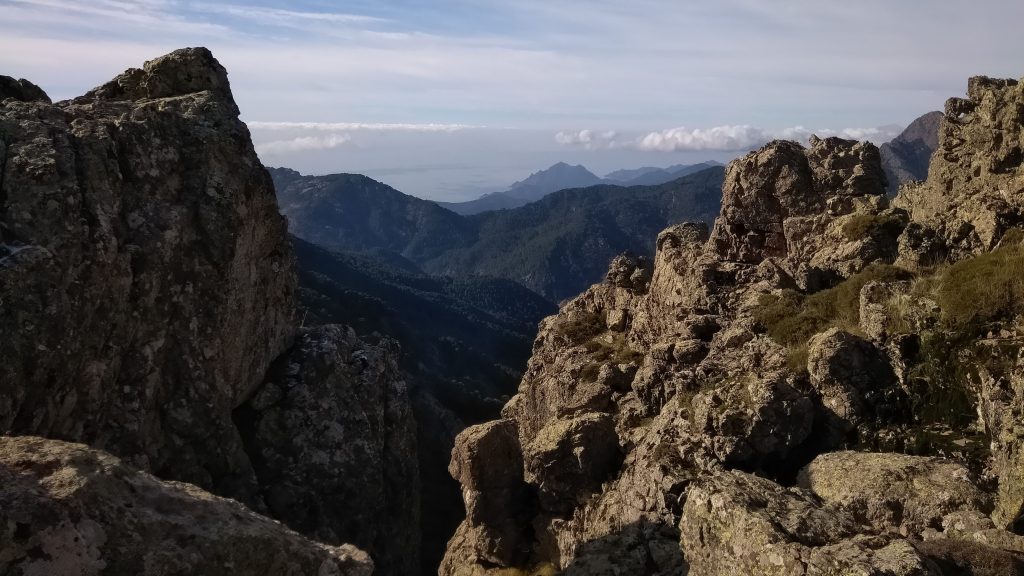
Turn right, follow the track 300m uphill to the BOCCA DI CUCCAVERA. Just before arriving at the col, you can turn left, walk through the trees to a rocky outcrop, climb up to see spectacular panoramic views of the island’s outline in the sea.


- BOCCA DU CUCCAVERA (to Bocca a u Saltu) 1h15 / 4.5km
Make your way back down 300m to the intersection with the forest path, it will be on your left. From here, continue on the wide grassy track, going downhill, for another 500m. You will come to an intersection with a forest track, turn left. Continue on, this forest track (ignore any tracks off on the right) it will start to loop up hill and bring you all the way back to BOCCA A U SALTU.
- BOCCA A U SALTU (to Paisolu Aitone) 1h15 / 3km
Retrace your steps from the col down the falling track, ignore the path to EVISA (on your right) and cross the PONT DE CASTERICA, continue on the track (ignoring the tracks to COL DE VERGIO or the ROUTE DES CONDAMNES) to cross the AITONE stream at the PONT DE Pompeani and continue straight on to the parking area.


